Bäk geodata
Bäk (Schleswig-Holstein) is a seat of a fourth-order administrative division; located in Germany in Europe/Berlin (GMT+2) time zone. With population of 826 people, there are 7794 cities with bigger population in this country. Compared to other cities in Germany, 88.8% of cities are located further ↓South; 63.8% of cities are located further ←West and 83.2% of cities have higher elevation than Bäk. Note1
Administrative division(s):
- Level 1: Schleswig-Holstein
- Level 3: Kreis Herzogtum Lauenburg
- Level 4: Bäk


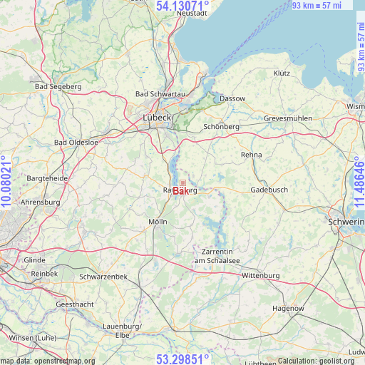
Bäk GPS coordinates[2]
53° 43' 0.012" North, 10° 46' 59.988" East
| Map corner | latitude | longitude |
|---|---|---|
| Upper-left | 54.13071°, | 10.08021° |
| Center: | 53.71667°, | 10.78333° |
| Lower-right: | 53.29851°, | 11.48646° |
| Map W x H: | 92.5×92.5 km | = 57.5×57.5mi |
| max Lat: | 55.01917° ⇑11.2% North |
| Bäk: | 53.71667° |
| min Lat: | ⇓88.8% South 47.40724° |
| min Long | Bäk | max Long |
| 5.92978° | 10.78333° | 14.98853° |
| W 63.8%⇐ | ⇒36.2% E |
Elevation
Elevation of Bäk is 39 m = 128 ft, and this is 210.1 m = 689 ft below average elevation for this country.
| Max E: |
1256 m = 4121 ft | 83.2% |
| Avg. | 249.1 m = 817 ft | |
| Bäk | 39 m = 128 ft | |
Min E: |
-5 m = -16 ft | 16.8% |
See also: Germany elevation on elevation.city.
Geographical zone
Bäk is located in North temperate zone (between Tropic of Cancer and the Arctic Circle). Distance of this North polar circle is 1428.4 km =887.6 mi to North.| Distance of | km | miles | from Bäk |
|---|---|---|---|
| North Pole | 4034.3 | 2506.8 | to North |
| Arctic Circle | 1428.4 | 887.6 | to North |
| Tropic Cancer | 3366.8 | 2092 | to South |
| Equator | 5972.7 | 3711.3 | to South |


Nearby cities:
15 places around Bäk: (largest is in red/bold)
• Albsfelde
6.6 km =4.1 mi,  235°
235°
• Buchholz
2.9 km =1.8 mi,  310°
310°
• Einhaus
3.3 km =2.1 mi,  270°
270°
• Fredeburg
7.1 km =4.4 mi,  218°
218°
• Giesensdorf
6.6 km =4.1 mi, 235°
• Groß Sarau
6.5 km =4 mi,  329°
329°
• Harmsdorf
4.8 km =3 mi,  247°
247°
• Kulpin
5.9 km =3.7 mi,  262°
262°
• Mechow
1.1 km =0.7 mi,  90°
90°
• Pogeez
5.3 km =3.3 mi,  316°
316°
• Ratzeburg
2 km =1.2 mi,  200°
200°
• Römnitz
1.1 km =0.7 mi, 270°
• Schlagsdorf
3.4 km =2.1 mi,  55°
55°
• Schmilau
6.3 km =3.9 mi, 196°
• Ziethen
3 km =1.9 mi,  145°
145°
Sources, notices
• [Note1] Compared only with cities in Germany existing in our database
• [Src1] Map data: © OpenStreetMap contributors (CC-BY-SA)
• [Src2] Other city data from geonames.org with taken over terms of usage.
• [Src3] Geographical zone / Annual Mean Temperature by Robert A. Rohde @ Wikipedia
