Saarlouis geodata
Saarlouis (Saarland) is a seat of a third-order administrative division; located in Germany in Europe/Berlin (GMT+2) time zone. With population of 38,333 people, there are 343 cities with bigger population in this country. Compared to other cities in Germany, 78.5% of cities are located further ↑North; 96% of cities are located further →East and 55.8% of cities have higher elevation than Saarlouis. Note1
Administrative division(s):
- Level 1: Saarland
- Level 3: Landkreis Saarlouis
- Level 4: Saarlouis, Kreisstadt


Saarlouis GPS coordinates[2]
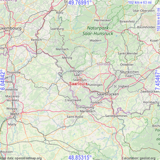
49° 18' 49.176" North, 6° 45' 5.544" East
| Map corner | latitude | longitude |
|---|---|---|
| Upper-left | 49.76991°, | 6.04842° |
| Center: | 49.31366°, | 6.75154° |
| Lower-right: | 48.85315°, | 7.45467° |
| Map W x H: | 101.9×101.9 km | = 63.3×63.3mi |
| max Lat: | 55.01917° ⇑78.5% North |
| Saarlouis: | 49.31366° |
| min Lat: | ⇓21.5% South 47.40724° |
| min Long | Saarlouis | max Long |
| 5.92978° | 6.75154° | 14.98853° |
| W 4%⇐ | ⇒96% E |
Elevation
Elevation of Saarlouis is 183 m = 600 ft, and this is 66.1 m = 217 ft below average elevation for this country.
| Max E: |
1256 m = 4121 ft | 55.8% |
| Avg. | 249.1 m = 817 ft | |
| Saarlouis | 183 m = 600 ft | |
Min E: |
-5 m = -16 ft | 44.2% |
See also: Germany elevation on elevation.city.
Geographical zone
Saarlouis is located in North temperate zone (between Tropic of Cancer and the Arctic Circle). Distance of this North polar circle is 1918 km =1191.8 mi to North.| Distance of | km | miles | from Saarlouis |
|---|---|---|---|
| North Pole | 4523.9 | 2811 | to North |
| Arctic Circle | 1918 | 1191.8 | to North |
| Tropic Cancer | 2877.2 | 1787.8 | to South |
| Equator | 5483.2 | 3407.1 | to South |


Nearby cities:
15 places around Saarlouis: (largest is in red/bold)
• Altforweiler
5.5 km =3.4 mi,  216°
216°
• Berus
6.8 km =4.2 mi, 216°
• Bisten
7.3 km =4.5 mi,  206°
206°
• Bous
5.4 km =3.4 mi,  138°
138°
• Dillingen
5 km =3.1 mi,  339°
339°
• Ensdorf
2.8 km =1.7 mi,  123°
123°
• Hostenbach
7.2 km =4.5 mi, 140°
• Nalbach
8.1 km =5 mi,  16°
16°
• Röchling-Höhe
7.7 km =4.8 mi,  128°
128°
• Saarwellingen
5.9 km =3.7 mi,  40°
40°
• Schaffhausen
7.7 km =4.8 mi,  146°
146°
• Schwalbach
5 km =3.1 mi,  107°
107°
• Wadgassen
5.7 km =3.5 mi,  156°
156°
• Wallerfangen
3.3 km =2.1 mi,  297°
297°
• Überherrn
8.9 km =5.5 mi, 205°
Sources, notices
• [Note1] Compared only with cities in Germany existing in our database
• [Src1] Map data: © OpenStreetMap contributors (CC-BY-SA)
• [Src2] Other city data from geonames.org with taken over terms of usage.
• [Src3] Geographical zone / Annual Mean Temperature by Robert A. Rohde @ Wikipedia
