Saarbrücken geodata
Saarbrücken (Saarland) is a seat of a first-order administrative division; located in Germany in Europe/Berlin (GMT+2) time zone. With population of 181,227 people, there are 51 cities with bigger population in this country. Compared to other cities in Germany, 79.9% of cities are located further ↑North; 93.2% of cities are located further →East and 54.2% of cities have higher elevation than Saarbrücken. Note1
Administrative division(s):
- Level 1: Saarland
- Level 3: Regionalverband Saarbrücken
- Level 4: Saarbrücken, Landeshauptstadt


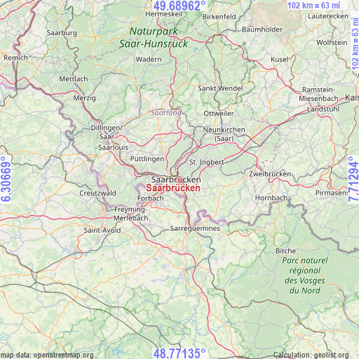
Saarbrücken GPS coordinates[2]
49° 13' 57.432" North, 7° 0' 35.352" East
| Map corner | latitude | longitude |
|---|---|---|
| Upper-left | 49.68962°, | 6.30669° |
| Center: | 49.23262°, | 7.00982° |
| Lower-right: | 48.77135°, | 7.71294° |
| Map W x H: | 102.1×102.1 km | = 63.4×63.4mi |
| max Lat: | 55.01917° ⇑79.9% North |
| Saarbrücken: | 49.23262° |
| min Lat: | ⇓20.1% South 47.40724° |
| min Long | Saarbrücken | max Long |
| 5.92978° | 7.00982° | 14.98853° |
| W 6.8%⇐ | ⇒93.2% E |
Elevation
Elevation of Saarbrücken is 195 m = 640 ft, and this is 54.1 m = 177 ft below average elevation for this country.
| Max E: |
1256 m = 4121 ft | 54.2% |
| Avg. | 249.1 m = 817 ft | |
| Saarbrücken | 195 m = 640 ft | |
Min E: |
-5 m = -16 ft | 45.8% |
See also: Saarbrücken elevation on elevation.city.
Geographical zone
Saarbrücken is located in North temperate zone (between Tropic of Cancer and the Arctic Circle). Distance of this North polar circle is 1927 km =1197.4 mi to North.| Distance of | km | miles | from Saarbrücken |
|---|---|---|---|
| North Pole | 4532.9 | 2816.6 | to North |
| Arctic Circle | 1927 | 1197.4 | to North |
| Tropic Cancer | 2868.2 | 1782.2 | to South |
| Equator | 5474.2 | 3401.5 | to South |


Nearby cities:
15 places around Saarbrücken: (largest is in red/bold)
• Fenne
9.2 km =5.7 mi,  280°
280°
• Friedrichsthal
12.3 km =7.6 mi,  30°
30°
• Fürstenhausen
10.3 km =6.4 mi, 275°
• Großrosseln
12.7 km =7.9 mi,  254°
254°
• Heidstock
9.7 km =6 mi,  285°
285°
• Heusweiler
12.9 km =8 mi,  333°
333°
• Kleinblittersdorf
8.6 km =5.3 mi,  166°
166°
• Luisenthal
8.1 km =5 mi, 283°
• Püttlingen
10.7 km =6.6 mi,  303°
303°
• Quierschied
9.8 km =6.1 mi,  17°
17°
• Riegelsberg
9.3 km =5.8 mi,  323°
323°
• Sankt Ingbert
9.2 km =5.7 mi,  57°
57°
• Spiesen-Elversberg
12.9 km =8 mi,  43°
43°
• Sulzbach
8.1 km =5 mi, 24°
• Völklingen
11.2 km =7 mi, 280°
In other languages:
- In Spanish: Sarrebruck
- In France: Sarrebruck
- In Russian: Саарбрюккен
- In Chinese: 萨尔布吕肯
Sources, notices
• [Note1] Compared only with cities in Germany existing in our database
• [Src1] Map data: © OpenStreetMap contributors (CC-BY-SA)
• [Src2] Other city data from geonames.org with taken over terms of usage.
• [Src3] Geographical zone / Annual Mean Temperature by Robert A. Rohde @ Wikipedia
