Friedrichsthal geodata
Friedrichsthal (Saarland) is a populated place; located in Germany in Europe/Berlin (GMT+2) time zone. With population of 11,440 people, there are 1441 cities with bigger population in this country. Compared to other cities in Germany, 78.2% of cities are located further ↑North; 92.4% of cities are located further →East and 63.1% of cities have lower elevation than Friedrichsthal. Note1
Administrative division(s):
- Level 1: Saarland
- Level 3: Regionalverband Saarbrücken
- Level 4: Friedrichsthal


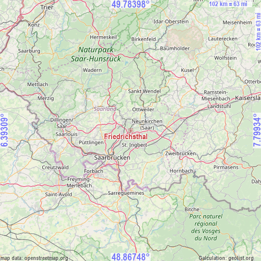
Friedrichsthal GPS coordinates[2]
49° 19' 40.296" North, 7° 5' 46.392" East
| Map corner | latitude | longitude |
|---|---|---|
| Upper-left | 49.78398°, | 6.39309° |
| Center: | 49.32786°, | 7.09622° |
| Lower-right: | 48.86748°, | 7.79934° |
| Map W x H: | 101.9×101.9 km | = 63.3×63.3mi |
| max Lat: | 55.01917° ⇑78.2% North |
| Friedrichsthal: | 49.32786° |
| min Lat: | ⇓21.8% South 47.40724° |
| min Long | Friedrichsthal | max Long |
| 5.92978° | 7.09622° | 14.98853° |
| W 7.6%⇐ | ⇒92.4% E |
Elevation
Elevation of Friedrichsthal is 309 m = 1014 ft, and this is 59.9 m = 197 ft above average elevation for this country.
| Max E: |
1256 m = 4121 ft | 36.9% |
| Friedrichsthal | 309 m 1014 ft | |
| Avg. | 249.1 m = 817 ft | |
Min E: |
-5 m = -16 ft | 63.1% |
See also: Germany elevation on elevation.city.
Geographical zone
Friedrichsthal is located in North temperate zone (between Tropic of Cancer and the Arctic Circle). Distance of this North polar circle is 1916.4 km =1190.8 mi to North.| Distance of | km | miles | from Friedrichsthal |
|---|---|---|---|
| North Pole | 4522.3 | 2810 | to North |
| Arctic Circle | 1916.4 | 1190.8 | to North |
| Tropic Cancer | 2878.8 | 1788.8 | to South |
| Equator | 5484.7 | 3408 | to South |


Nearby cities:
15 places around Friedrichsthal: (largest is in red/bold)
• Bexbach
11.7 km =7.3 mi,  79°
79°
• Hangard
10.3 km =6.4 mi,  53°
53°
• Heusweiler
12.1 km =7.5 mi,  274°
274°
• Illingen
6.2 km =3.9 mi,  325°
325°
• Kirkel
11.1 km =6.9 mi,  116°
116°
• Mainzweiler
10.1 km =6.3 mi,  9°
9°
• Merchweiler
4.2 km =2.6 mi,  306°
306°
• Neunkirchen
6.4 km =4 mi,  73°
73°
• Ottweiler
9.5 km =5.9 mi,  31°
31°
• Quierschied
3.6 km =2.2 mi,  249°
249°
• Riegelsberg
12.2 km =7.6 mi,  255°
255°
• Sankt Ingbert
5.9 km =3.7 mi,  165°
165°
• Schiffweiler
5.1 km =3.2 mi, 31°
• Spiesen-Elversberg
3 km =1.9 mi,  114°
114°
• Sulzbach
4.3 km =2.7 mi,  221°
221°
Sources, notices
• [Note1] Compared only with cities in Germany existing in our database
• [Src1] Map data: © OpenStreetMap contributors (CC-BY-SA)
• [Src2] Other city data from geonames.org with taken over terms of usage.
• [Src3] Geographical zone / Annual Mean Temperature by Robert A. Rohde @ Wikipedia
