Ruppertsberg geodata
Ruppertsberg (Rheinland-Pfalz) is a seat of a fourth-order administrative division; located in Germany in Europe/Berlin (GMT+2) time zone. With population of 1,416 people, there are 6048 cities with bigger population in this country. Compared to other cities in Germany, 77.1% of cities are located further ↑North; 74.2% of cities are located further →East and 64.6% of cities have higher elevation than Ruppertsberg. Note1
Administrative division(s):
- Level 1: Rheinland-Pfalz
- Level 3: Landkreis Bad Dürkheim
- Level 4: Ruppertsberg


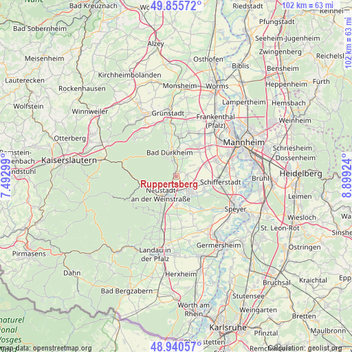
Ruppertsberg GPS coordinates[2]
49° 24' 1.008" North, 8° 11' 45.996" East
| Map corner | latitude | longitude |
|---|---|---|
| Upper-left | 49.85572°, | 7.49299° |
| Center: | 49.40028°, | 8.19611° |
| Lower-right: | 48.94057°, | 8.89924° |
| Map W x H: | 101.8×101.8 km | = 63.3×63.3mi |
| max Lat: | 55.01917° ⇑77.1% North |
| Ruppertsberg: | 49.40028° |
| min Lat: | ⇓22.9% South 47.40724° |
| min Long | Ruppertsberg | max Long |
| 5.92978° | 8.19611° | 14.98853° |
| W 25.8%⇐ | ⇒74.2% E |
Elevation
Elevation of Ruppertsberg is 123 m = 404 ft, and this is 126.1 m = 414 ft below average elevation for this country.
| Max E: |
1256 m = 4121 ft | 64.6% |
| Avg. | 249.1 m = 817 ft | |
| Ruppertsberg | 123 m = 404 ft | |
Min E: |
-5 m = -16 ft | 35.4% |
See also: Germany elevation on elevation.city.
Geographical zone
Ruppertsberg is located in North temperate zone (between Tropic of Cancer and the Arctic Circle). Distance of this North polar circle is 1908.4 km =1185.8 mi to North.| Distance of | km | miles | from Ruppertsberg |
|---|---|---|---|
| North Pole | 4514.3 | 2805.1 | to North |
| Arctic Circle | 1908.4 | 1185.8 | to North |
| Tropic Cancer | 2886.9 | 1793.8 | to South |
| Equator | 5492.8 | 3413.1 | to South |


Nearby cities:
15 places around Ruppertsberg: (largest is in red/bold)
• Bad Dürkheim
7.1 km =4.4 mi,  345°
345°
• Böhl-Iggelheim
8.1 km =5 mi,  105°
105°
• Deidesheim
1.2 km =0.7 mi,  314°
314°
• Forst
2.9 km =1.8 mi, 350°
• Friedelsheim
5.5 km =3.4 mi,  20°
20°
• Gönnheim
6.1 km =3.8 mi,  30°
30°
• Haßloch
6.1 km =3.8 mi,  132°
132°
• Hochdorf-Assenheim
6.5 km =4 mi,  71°
71°
• Lachen-Speyerdorf
7.8 km =4.8 mi,  178°
178°
• Lindenberg
7.4 km =4.6 mi,  252°
252°
• Meckenheim
3.1 km =1.9 mi,  81°
81°
• Neustadt
7 km =4.3 mi,  216°
216°
• Niederkirchen bei Deidesheim
1.9 km =1.2 mi, 31°
• Rödersheim-Gronau
5.8 km =3.6 mi,  55°
55°
• Wachenheim
4.6 km =2.9 mi, 345°
Sources, notices
• [Note1] Compared only with cities in Germany existing in our database
• [Src1] Map data: © OpenStreetMap contributors (CC-BY-SA)
• [Src2] Other city data from geonames.org with taken over terms of usage.
• [Src3] Geographical zone / Annual Mean Temperature by Robert A. Rohde @ Wikipedia
