Wachenheim geodata
Wachenheim (Rheinland-Pfalz) is a populated place; located in Germany in Europe/Berlin (GMT+2) time zone. With population of 4,678 people, there are 2947 cities with bigger population in this country. Compared to other cities in Germany, 76.7% of cities are located further ↑North; 74.4% of cities are located further →East and 59.1% of cities have higher elevation than Wachenheim. Note1
Administrative division(s):
- Level 1: Rheinland-Pfalz
- Level 3: Landkreis Bad Dürkheim
- Level 4: Wachenheim an der Weinstraße


Wachenheim GPS coordinates[2]
49° 26' 25.62" North, 8° 10' 49.476" East
| Map corner | latitude | longitude |
|---|---|---|
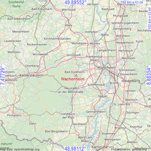
| Upper-left | 49.89552°, | 7.47729° |
| Center: | 49.44045°, | 8.18041° |
| Lower-right: | 48.98112°, | 8.88354° |
| Map W x H: | 101.7×101.7 km | = 63.2×63.2mi |
| max Lat: | 55.01917° ⇑76.7% North |
| Wachenheim: | 49.44045° |
| min Lat: | ⇓23.3% South 47.40724° |
| min Long | Wachenheim | max Long |
| 5.92978° | 8.18041° | 14.98853° |
| W 25.6%⇐ | ⇒74.4% E |
Elevation
Elevation of Wachenheim is 160 m = 525 ft, and this is 89.1 m = 292 ft below average elevation for this country.
| Max E: |
1256 m = 4121 ft | 59.1% |
| Avg. | 249.1 m = 817 ft | |
| Wachenheim | 160 m = 525 ft | |
Min E: |
-5 m = -16 ft | 40.9% |
See also: Germany elevation on elevation.city.
Geographical zone
Wachenheim is located in North temperate zone (between Tropic of Cancer and the Arctic Circle). Distance of this North polar circle is 1903.9 km =1183 mi to North.| Distance of | km | miles | from Wachenheim |
|---|---|---|---|
| North Pole | 4509.8 | 2802.3 | to North |
| Arctic Circle | 1903.9 | 1183 | to North |
| Tropic Cancer | 2891.3 | 1796.6 | to South |
| Equator | 5497.3 | 3415.9 | to South |


Nearby cities:
15 places around Wachenheim: (largest is in red/bold)
• Bad Dürkheim
2.4 km =1.5 mi,  346°
346°
• Birkenheide
7.4 km =4.6 mi,  52°
52°
• Deidesheim
3.6 km =2.2 mi,  175°
175°
• Ellerstadt
6.2 km =3.9 mi,  67°
67°
• Erpolzheim
6.3 km =3.9 mi,  30°
30°
• Forst
1.8 km =1.1 mi,  157°
157°
• Freinsheim
7.7 km =4.8 mi,  17°
17°
• Friedelsheim
3.2 km =2 mi,  76°
76°
• Gönnheim
4.3 km =2.7 mi, 78°
• Herxheim am Berg
7.6 km =4.7 mi,  359°
359°
• Kallstadt
5.6 km =3.5 mi, 356°
• Meckenheim
5.8 km =3.6 mi,  133°
133°
• Niederkirchen bei Deidesheim
3.5 km =2.2 mi,  142°
142°
• Ruppertsberg
4.6 km =2.9 mi,  165°
165°
• Rödersheim-Gronau
6 km =3.7 mi,  101°
101°
In other languages:
- In German: Wachenheim an der Weinstraße
- In Russian: Вахенхайм
- In Chinese: 韦因斯特拉塞地区瓦亨海姆
Sources, notices
• [Note1] Compared only with cities in Germany existing in our database
• [Src1] Map data: © OpenStreetMap contributors (CC-BY-SA)
• [Src2] Other city data from geonames.org with taken over terms of usage.
• [Src3] Geographical zone / Annual Mean Temperature by Robert A. Rohde @ Wikipedia
