Rodleben geodata
Rodleben (Saxony-Anhalt) is a populated place; located in Germany in Europe/Berlin (GMT+2) time zone. With population of 1,673 people, there are 5565 cities with bigger population in this country. Compared to other cities in Germany, 71.1% of cities are located further ↓South; 84.7% of cities are located further ←West and 72.8% of cities have higher elevation than Rodleben. Note1


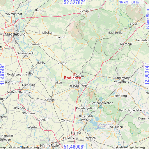
Rodleben GPS coordinates[2]
51° 53' 45.852" North, 12° 12' 2.196" East
| Map corner | latitude | longitude |
|---|---|---|
| Upper-left | 52.32787°, | 11.49749° |
| Center: | 51.89607°, | 12.20061° |
| Lower-right: | 51.46008°, | 12.90374° |
| Map W x H: | 96.5×96.5 km | = 60×60mi |
| max Lat: | 55.01917° ⇑28.9% North |
| Rodleben: | 51.89607° |
| min Lat: | ⇓71.1% South 47.40724° |
| min Long | Rodleben | max Long |
| 5.92978° | 12.20061° | 14.98853° |
| W 84.7%⇐ | ⇒15.3% E |
Elevation
Elevation of Rodleben is 73 m = 240 ft, and this is 176.1 m = 578 ft below average elevation for this country.
| Max E: |
1256 m = 4121 ft | 72.8% |
| Avg. | 249.1 m = 817 ft | |
| Rodleben | 73 m = 240 ft | |
Min E: |
-5 m = -16 ft | 27.2% |
See also: Germany elevation on elevation.city.
Geographical zone
Rodleben is located in North temperate zone (between Tropic of Cancer and the Arctic Circle). Distance of this North polar circle is 1630.9 km =1013.4 mi to North.| Distance of | km | miles | from Rodleben |
|---|---|---|---|
| North Pole | 4236.8 | 2632.6 | to North |
| Arctic Circle | 1630.9 | 1013.4 | to North |
| Tropic Cancer | 3164.4 | 1966.3 | to South |
| Equator | 5770.3 | 3585.5 | to South |


Nearby cities:
15 places around Rodleben: (largest is in red/bold)
• Aken
11.7 km =7.3 mi,  245°
245°
• Bornum
9.3 km =5.8 mi,  1°
1°
• Dessau
7.1 km =4.4 mi,  154°
154°
• Elsnigk
15.3 km =9.5 mi,  220°
220°
• Jeber-Bergfrieden
14.1 km =8.8 mi,  46°
46°
• Jütrichau
6.6 km =4.1 mi,  313°
313°
• Klieken
11.7 km =7.3 mi,  94°
94°
• Osternienburg
16.5 km =10.3 mi,  226°
226°
• Osternienburger Land
16.5 km =10.3 mi, 229°
• Roßlau
3 km =1.9 mi,  108°
108°
• Steutz
8.7 km =5.4 mi,  256°
256°
• Thießen
9.5 km =5.9 mi, 45°
• Vockerode
11.7 km =7.3 mi,  117°
117°
• Wörlitz
16.3 km =10.1 mi, 111°
• Zerbst
11.1 km =6.9 mi, 314°
Sources, notices
• [Note1] Compared only with cities in Germany existing in our database
• [Src1] Map data: © OpenStreetMap contributors (CC-BY-SA)
• [Src2] Other city data from geonames.org with taken over terms of usage.
• [Src3] Geographical zone / Annual Mean Temperature by Robert A. Rohde @ Wikipedia
