Osternienburger Land geodata
Osternienburger Land (Saxony-Anhalt) is a seat of a fourth-order administrative division; located in Germany in Europe/Berlin (GMT+2) time zone. With population of 9,115 people, there are 1767 cities with bigger population in this country. Compared to other cities in Germany, 69.9% of cities are located further ↓South; 82% of cities are located further ←West and 74.7% of cities have higher elevation than Osternienburger Land. Note1
Administrative division(s):
- Level 1: Saxony-Anhalt
- Level 3: Anhalt-Bitterfeld
- Level 4: Osternienburger Land
Current local time in Osternienburger Land:
09:06 PM, WednesdayDifference from your time zone: hours


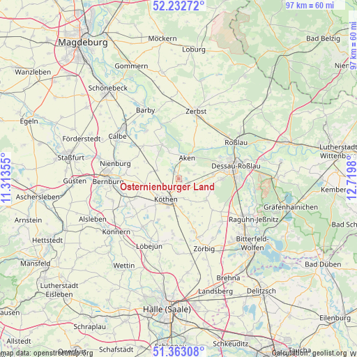
Osternienburger Land GPS coordinates[2]
51° 48' 0" North, 12° 1' 0.012" East
| Map corner | latitude | longitude |
|---|---|---|
| Upper-left | 52.23272°, | 11.31355° |
| Center: | 51.8°, | 12.01667° |
| Lower-right: | 51.36308°, | 12.7198° |
| Map W x H: | 96.7×96.7 km | = 60.1×60.1mi |
| max Lat: | 55.01917° ⇑30.1% North |
| Osternienburger Land: | 51.8° |
| min Lat: | ⇓69.9% South 47.40724° |
| min Long | Osternienburger | max Long |
| 5.92978° | 12.01667° | 14.98853° |
| W 82%⇐ | ⇒18% E |
Elevation
Elevation of Osternienburger Land is 64 m = 210 ft, and this is 185.1 m = 607 ft below average elevation for this country.
| Max E: |
1256 m = 4121 ft | 74.7% |
| Avg. | 249.1 m = 817 ft | |
| Osternienburger Land | 64 m = 210 ft | |
Min E: |
-5 m = -16 ft | 25.3% |
See also: Germany elevation on elevation.city.
Geographical zone
Osternienburger Land is located in North temperate zone (between Tropic of Cancer and the Arctic Circle). Distance of this North polar circle is 1641.6 km =1020 mi to North.| Distance of | km | miles | from Osternienburger Land |
|---|---|---|---|
| North Pole | 4247.4 | 2639.2 | to North |
| Arctic Circle | 1641.6 | 1020 | to North |
| Tropic Cancer | 3153.7 | 1959.6 | to South |
| Equator | 5759.6 | 3578.8 | to South |


Nearby cities:
15 places around Osternienburger Land: (largest is in red/bold)
• Aken
6.2 km =3.9 mi,  18°
18°
• Drosa
7.8 km =4.8 mi,  283°
283°
• Elsnigk
2.9 km =1.8 mi,  109°
109°
• Großbadegast
7.7 km =4.8 mi,  174°
174°
• Großpaschleben
7.2 km =4.5 mi,  233°
233°
• Kleinpaschleben
9.3 km =5.8 mi,  258°
258°
• Köthen
6.2 km =3.9 mi,  210°
210°
• Micheln
3.3 km =2.1 mi,  287°
287°
• Osternienburg
0.9 km =0.6 mi,  136°
136°
• Prosigk
11.5 km =7.1 mi, 166°
• Quellendorf
9.5 km =5.9 mi,  126°
126°
• Steutz
9.6 km =6 mi,  26°
26°
• Wohlsdorf
11.1 km =6.9 mi,  249°
249°
• Wulfen
6.3 km =3.9 mi, 290°
• Zabitz
6.6 km =4.1 mi, 255°
Sources, notices
• [Note1] Compared only with cities in Germany existing in our database
• [Src1] Map data: © OpenStreetMap contributors (CC-BY-SA)
• [Src2] Other city data from geonames.org with taken over terms of usage.
• [Src3] Geographical zone / Annual Mean Temperature by Robert A. Rohde @ Wikipedia
