Ringleben geodata
Ringleben (Thuringia) is a seat of a fourth-order administrative division; located in Germany in Europe/Berlin (GMT+2) time zone. With population of 1,043 people, there are 7036 cities with bigger population in this country. Compared to other cities in Germany, 64.2% of cities are located further ↓South; 70.2% of cities are located further ←West and 63.9% of cities have higher elevation than Ringleben. Note1
Administrative division(s):
- Level 1: Thuringia
- Level 3: Kyffhäuserkreis
- Level 4: Bad Frankenhausen/Kyffhäuser


Ringleben GPS coordinates[2]
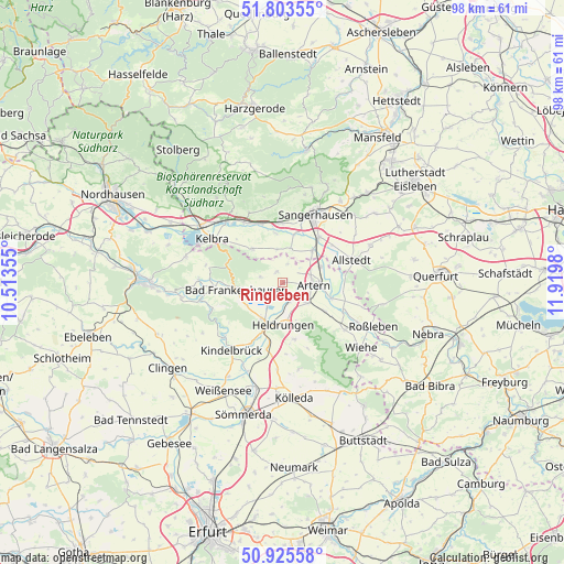
51° 22' 0.012" North, 11° 13' 0.012" East
| Map corner | latitude | longitude |
|---|---|---|
| Upper-left | 51.80355°, | 10.51355° |
| Center: | 51.36667°, | 11.21667° |
| Lower-right: | 50.92558°, | 11.9198° |
| Map W x H: | 97.6×97.6 km | = 60.6×60.6mi |
| max Lat: | 55.01917° ⇑35.8% North |
| Ringleben: | 51.36667° |
| min Lat: | ⇓64.2% South 47.40724° |
| min Long | Ringleben | max Long |
| 5.92978° | 11.21667° | 14.98853° |
| W 70.2%⇐ | ⇒29.8% E |
Elevation
Elevation of Ringleben is 127 m = 417 ft, and this is 122.1 m = 401 ft below average elevation for this country.
| Max E: |
1256 m = 4121 ft | 63.9% |
| Avg. | 249.1 m = 817 ft | |
| Ringleben | 127 m = 417 ft | |
Min E: |
-5 m = -16 ft | 36.1% |
See also: Germany elevation on elevation.city.
Geographical zone
Ringleben is located in North temperate zone (between Tropic of Cancer and the Arctic Circle). Distance of this North polar circle is 1689.7 km =1049.9 mi to North.| Distance of | km | miles | from Ringleben |
|---|---|---|---|
| North Pole | 4295.6 | 2669.2 | to North |
| Arctic Circle | 1689.7 | 1049.9 | to North |
| Tropic Cancer | 3105.5 | 1929.7 | to South |
| Equator | 5711.4 | 3548.9 | to South |


Nearby cities:
15 places around Ringleben: (largest is in red/bold)
• Artern
5.2 km =3.2 mi,  92°
92°
• Bad Frankenhausen
8.2 km =5.1 mi,  261°
261°
• Borxleben
3.9 km =2.4 mi,  17°
17°
• Bretleben
3.9 km =2.4 mi,  162°
162°
• Brücken
8.7 km =5.4 mi,  351°
351°
• Edersleben
7.2 km =4.5 mi,  39°
39°
• Esperstedt
3.4 km =2.1 mi,  230°
230°
• Gehofen
8.7 km =5.4 mi,  124°
124°
• Heldrungen
7.2 km =4.5 mi,  179°
179°
• Ichstedt
2.2 km =1.4 mi,  328°
328°
• Oldisleben
7.1 km =4.4 mi,  206°
206°
• Reinsdorf
5.1 km =3.2 mi,  136°
136°
• Riethnordhausen
6.2 km =3.9 mi,  12°
12°
• Tilleda
8 km =5 mi,  318°
318°
• Voigtstedt
7 km =4.3 mi,  66°
66°
Sources, notices
• [Note1] Compared only with cities in Germany existing in our database
• [Src1] Map data: © OpenStreetMap contributors (CC-BY-SA)
• [Src2] Other city data from geonames.org with taken over terms of usage.
• [Src3] Geographical zone / Annual Mean Temperature by Robert A. Rohde @ Wikipedia
