Ichstedt geodata
Ichstedt (Thuringia) is a seat of a fourth-order administrative division; located in Germany in Europe/Berlin (GMT+2) time zone. With population of 728 people, there are 8203 cities with bigger population in this country. Compared to other cities in Germany, 64.4% of cities are located further ↓South; 69.9% of cities are located further ←West and 61.1% of cities have higher elevation than Ichstedt. Note1
Administrative division(s):
- Level 1: Thuringia
- Level 3: Kyffhäuserkreis
- Level 4: Bad Frankenhausen/Kyffhäuser


Ichstedt GPS coordinates[2]
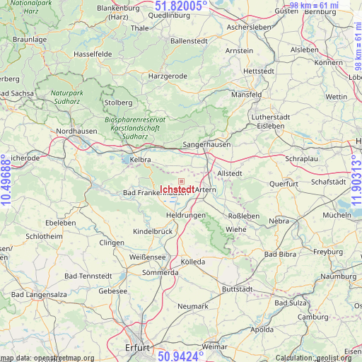
51° 22' 59.988" North, 11° 12' 0" East
| Map corner | latitude | longitude |
|---|---|---|
| Upper-left | 51.82005°, | 10.49688° |
| Center: | 51.38333°, | 11.2° |
| Lower-right: | 50.9424°, | 11.90313° |
| Map W x H: | 97.6×97.6 km | = 60.6×60.6mi |
| max Lat: | 55.01917° ⇑35.6% North |
| Ichstedt: | 51.38333° |
| min Lat: | ⇓64.4% South 47.40724° |
| min Long | Ichstedt | max Long |
| 5.92978° | 11.2° | 14.98853° |
| W 69.9%⇐ | ⇒30.1% E |
Elevation
Elevation of Ichstedt is 145 m = 476 ft, and this is 104.1 m = 342 ft below average elevation for this country.
| Max E: |
1256 m = 4121 ft | 61.1% |
| Avg. | 249.1 m = 817 ft | |
| Ichstedt | 145 m = 476 ft | |
Min E: |
-5 m = -16 ft | 38.9% |
See also: Germany elevation on elevation.city.
Geographical zone
Ichstedt is located in North temperate zone (between Tropic of Cancer and the Arctic Circle). Distance of this North polar circle is 1687.9 km =1048.8 mi to North.| Distance of | km | miles | from Ichstedt |
|---|---|---|---|
| North Pole | 4293.8 | 2668 | to North |
| Arctic Circle | 1687.9 | 1048.8 | to North |
| Tropic Cancer | 3107.4 | 1930.8 | to South |
| Equator | 5713.3 | 3550.1 | to South |


Nearby cities:
15 places around Ichstedt: (largest is in red/bold)
• Artern
6.7 km =4.2 mi,  108°
108°
• Bad Frankenhausen
7.6 km =4.7 mi,  246°
246°
• Borxleben
3 km =1.9 mi,  51°
51°
• Bretleben
6 km =3.7 mi,  157°
157°
• Brücken
6.7 km =4.2 mi,  358°
358°
• Edersleben
6.9 km =4.3 mi,  57°
57°
• Esperstedt
4.3 km =2.7 mi,  200°
200°
• Heldrungen
9.1 km =5.7 mi,  172°
172°
• Oldisleben
8.4 km =5.2 mi,  193°
193°
• Reinsdorf
7.2 km =4.5 mi,  140°
140°
• Riethnordhausen
4.9 km =3 mi,  31°
31°
• Ringleben
2.2 km =1.4 mi,  148°
148°
• Tilleda
5.8 km =3.6 mi,  314°
314°
• Voigtstedt
7.6 km =4.7 mi,  82°
82°
• Wallhausen
8.7 km =5.4 mi,  3°
3°
Sources, notices
• [Note1] Compared only with cities in Germany existing in our database
• [Src1] Map data: © OpenStreetMap contributors (CC-BY-SA)
• [Src2] Other city data from geonames.org with taken over terms of usage.
• [Src3] Geographical zone / Annual Mean Temperature by Robert A. Rohde @ Wikipedia
