Reinsdorf geodata
Reinsdorf (Thuringia) is a seat of a fourth-order administrative division; located in Germany in Europe/Berlin (GMT+2) time zone. In our database, there are 11009 cities with bigger population. Compared to other cities in Germany, 63.7% of cities are located further ↓South; 70.9% of cities are located further ←West and 62.7% of cities have higher elevation than Reinsdorf. Note1


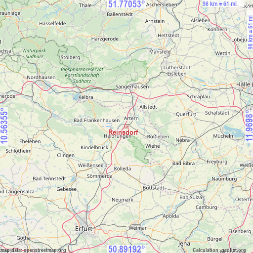
Reinsdorf GPS coordinates[2]
51° 19' 59.988" North, 11° 16' 0.012" East
| Map corner | latitude | longitude |
|---|---|---|
| Upper-left | 51.77053°, | 10.56355° |
| Center: | 51.33333°, | 11.26667° |
| Lower-right: | 50.89192°, | 11.9698° |
| Map W x H: | 97.7×97.7 km | = 60.7×60.7mi |
| max Lat: | 55.01917° ⇑36.3% North |
| Reinsdorf: | 51.33333° |
| min Lat: | ⇓63.7% South 47.40724° |
| min Long | Reinsdorf | max Long |
| 5.92978° | 11.26667° | 14.98853° |
| W 70.9%⇐ | ⇒29.1% E |
Elevation
Elevation of Reinsdorf is 134 m = 440 ft, and this is 115.1 m = 378 ft below average elevation for this country.
| Max E: |
1256 m = 4121 ft | 62.7% |
| Avg. | 249.1 m = 817 ft | |
| Reinsdorf | 134 m = 440 ft | |
Min E: |
-5 m = -16 ft | 37.3% |
See also: Germany elevation on elevation.city.
Geographical zone
Reinsdorf is located in North temperate zone (between Tropic of Cancer and the Arctic Circle). Distance of this North polar circle is 1693.4 km =1052.2 mi to North.| Distance of | km | miles | from Reinsdorf |
|---|---|---|---|
| North Pole | 4299.3 | 2671.5 | to North |
| Arctic Circle | 1693.4 | 1052.2 | to North |
| Tropic Cancer | 3101.8 | 1927.4 | to South |
| Equator | 5707.7 | 3546.6 | to South |


Nearby cities:
15 places around Reinsdorf: (largest is in red/bold)
• Artern
3.9 km =2.4 mi,  26°
26°
• Bretleben
2.3 km =1.4 mi,  270°
270°
• Esperstedt
6.3 km =3.9 mi,  284°
284°
• Gehofen
3.9 km =2.4 mi,  107°
107°
• Hauteroda
7.5 km =4.7 mi,  171°
171°
• Heldrungen
4.8 km =3 mi,  224°
224°
• Heygendorf
6.9 km =4.3 mi,  73°
73°
• Ichstedt
7.2 km =4.5 mi,  320°
320°
• Kalbsrieth
5.2 km =3.2 mi,  79°
79°
• Nausitz
5 km =3.1 mi, 111°
• Oberheldrungen
5.7 km =3.5 mi,  191°
191°
• Oldisleben
7.1 km =4.4 mi,  248°
248°
• Ringleben
5.1 km =3.2 mi, 316°
• Schönewerda
7 km =4.3 mi,  98°
98°
• Voigtstedt
7.1 km =4.4 mi,  24°
24°
Sources, notices
• [Note1] Compared only with cities in Germany existing in our database
• [Src1] Map data: © OpenStreetMap contributors (CC-BY-SA)
• [Src2] Other city data from geonames.org with taken over terms of usage.
• [Src3] Geographical zone / Annual Mean Temperature by Robert A. Rohde @ Wikipedia
