Schlaitdorf geodata
Schlaitdorf (Baden-Württemberg) is a seat of a fourth-order administrative division; located in Germany in Europe/Berlin (GMT+2) time zone. With population of 1,663 people, there are 5580 cities with bigger population in this country. Compared to other cities in Germany, 87.7% of cities are located further ↑North; 61.9% of cities are located further →East and 75.1% of cities have lower elevation than Schlaitdorf. Note1
Administrative division(s):
- Level 1: Baden-Württemberg
- Level 2: Regierungsbezirk Stuttgart
- Level 3: Landkreis Esslingen
- Level 4: Schlaitdorf


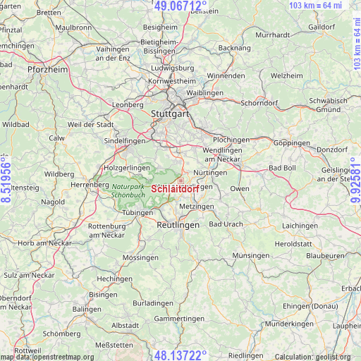
Schlaitdorf GPS coordinates[2]
48° 36' 15.516" North, 9° 13' 21.648" East
| Map corner | latitude | longitude |
|---|---|---|
| Upper-left | 49.06712°, | 8.51956° |
| Center: | 48.60431°, | 9.22268° |
| Lower-right: | 48.13722°, | 9.92581° |
| Map W x H: | 103.4×103.4 km | = 64.2×64.2mi |
| max Lat: | 55.01917° ⇑87.7% North |
| Schlaitdorf: | 48.60431° |
| min Lat: | ⇓12.3% South 47.40724° |
| min Long | Schlaitdorf | max Long |
| 5.92978° | 9.22268° | 14.98853° |
| W 38.1%⇐ | ⇒61.9% E |
Elevation
Elevation of Schlaitdorf is 398 m = 1306 ft, and this is 148.9 m = 489 ft above average elevation for this country.
| Max E: |
1256 m = 4121 ft | 24.9% |
| Schlaitdorf | 398 m 1306 ft | |
| Avg. | 249.1 m = 817 ft | |
Min E: |
-5 m = -16 ft | 75.1% |
See also: Germany elevation on elevation.city.
Geographical zone
Schlaitdorf is located in North temperate zone (between Tropic of Cancer and the Arctic Circle). Distance of this North polar circle is 1996.9 km =1240.8 mi to North.| Distance of | km | miles | from Schlaitdorf |
|---|---|---|---|
| North Pole | 4602.8 | 2860 | to North |
| Arctic Circle | 1996.9 | 1240.8 | to North |
| Tropic Cancer | 2798.4 | 1738.8 | to South |
| Equator | 5404.3 | 3358.1 | to South |


Nearby cities:
15 places around Schlaitdorf: (largest is in red/bold)
• Altdorf
3.8 km =2.4 mi,  107°
107°
• Altenriet
1.4 km =0.9 mi,  182°
182°
• Bempflingen
4.9 km =3 mi,  137°
137°
• Dettenhausen
9 km =5.6 mi,  272°
272°
• Filderstadt
5.9 km =3.7 mi,  358°
358°
• Großbettlingen
6.4 km =4 mi,  103°
103°
• Metzingen
8.7 km =5.4 mi,  149°
149°
• Neckartailfingen
3.1 km =1.9 mi,  74°
74°
• Neckartenzlingen
1.8 km =1.1 mi, 151°
• Nürtingen
9.1 km =5.7 mi, 74°
• Pliezhausen
5.1 km =3.2 mi,  192°
192°
• Riederich
6 km =3.7 mi, 145°
• Sickenhausen
8.5 km =5.3 mi,  200°
200°
• Waldenbuch
7.6 km =4.7 mi,  299°
299°
• Wolfschlugen
6.8 km =4.2 mi,  41°
41°
Sources, notices
• [Note1] Compared only with cities in Germany existing in our database
• [Src1] Map data: © OpenStreetMap contributors (CC-BY-SA)
• [Src2] Other city data from geonames.org with taken over terms of usage.
• [Src3] Geographical zone / Annual Mean Temperature by Robert A. Rohde @ Wikipedia
