Altenriet geodata
Altenriet (Baden-Württemberg) is a seat of a fourth-order administrative division; located in Germany in Europe/Berlin (GMT+2) time zone. With population of 1,820 people, there are 5317 cities with bigger population in this country. Compared to other cities in Germany, 88% of cities are located further ↑North; 62% of cities are located further →East and 76.2% of cities have lower elevation than Altenriet. Note1
Administrative division(s):
- Level 1: Baden-Württemberg
- Level 2: Regierungsbezirk Stuttgart
- Level 3: Landkreis Esslingen
- Level 4: Altenriet


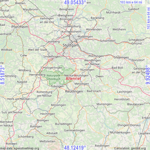
Altenriet GPS coordinates[2]
48° 35' 29.04" North, 9° 13' 18.696" East
| Map corner | latitude | longitude |
|---|---|---|
| Upper-left | 49.05433°, | 8.51873° |
| Center: | 48.5914°, | 9.22186° |
| Lower-right: | 48.12419°, | 9.92498° |
| Map W x H: | 103.4×103.4 km | = 64.2×64.2mi |
| max Lat: | 55.01917° ⇑88% North |
| Altenriet: | 48.5914° |
| min Lat: | ⇓12% South 47.40724° |
| min Long | Altenriet | max Long |
| 5.92978° | 9.22186° | 14.98853° |
| W 38%⇐ | ⇒62% E |
Elevation
Elevation of Altenriet is 407 m = 1335 ft, and this is 157.9 m = 518 ft above average elevation for this country.
| Max E: |
1256 m = 4121 ft | 23.8% |
| Altenriet | 407 m 1335 ft | |
| Avg. | 249.1 m = 817 ft | |
Min E: |
-5 m = -16 ft | 76.2% |
See also: Germany elevation on elevation.city.
Geographical zone
Altenriet is located in North temperate zone (between Tropic of Cancer and the Arctic Circle). Distance of this North polar circle is 1998.3 km =1241.7 mi to North.| Distance of | km | miles | from Altenriet |
|---|---|---|---|
| North Pole | 4604.2 | 2860.9 | to North |
| Arctic Circle | 1998.3 | 1241.7 | to North |
| Tropic Cancer | 2796.9 | 1737.9 | to South |
| Equator | 5402.9 | 3357.2 | to South |


Nearby cities:
15 places around Altenriet: (largest is in red/bold)
• Altdorf
3.7 km =2.3 mi,  85°
85°
• Bempflingen
4.1 km =2.5 mi,  122°
122°
• Filderstadt
7.3 km =4.5 mi,  359°
359°
• Großbettlingen
6.3 km =3.9 mi, 90°
• Kirchentellinsfurt
8.5 km =5.3 mi,  220°
220°
• Kohlberg
9.1 km =5.7 mi,  113°
113°
• Metzingen
7.6 km =4.7 mi,  143°
143°
• Neckartailfingen
3.8 km =2.4 mi,  53°
53°
• Neckartenzlingen
1 km =0.6 mi,  100°
100°
• Pliezhausen
3.7 km =2.3 mi,  196°
196°
• Riederich
4.9 km =3 mi, 135°
• Schlaitdorf
1.4 km =0.9 mi,  2°
2°
• Sickenhausen
7.2 km =4.5 mi, 204°
• Waldenbuch
8.4 km =5.2 mi,  308°
308°
• Wolfschlugen
7.9 km =4.9 mi,  34°
34°
Sources, notices
• [Note1] Compared only with cities in Germany existing in our database
• [Src1] Map data: © OpenStreetMap contributors (CC-BY-SA)
• [Src2] Other city data from geonames.org with taken over terms of usage.
• [Src3] Geographical zone / Annual Mean Temperature by Robert A. Rohde @ Wikipedia
