Ramsau geodata
Ramsau (Bavaria) is a populated place; located in Germany in Europe/Berlin (GMT+2) time zone. With population of 1,806 people, there are 5339 cities with bigger population in this country. Compared to other cities in Germany, 93% of cities are located further ↑North; 85.1% of cities are located further ←West and 89.6% of cities have lower elevation than Ramsau. Note1
Administrative division(s):
- Level 1: Bavaria
- Level 2: Upper Bavaria
- Level 3: Landkreis Mühldorf am Inn
- Level 4: Reichertsheim


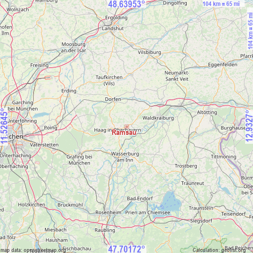
Ramsau GPS coordinates[2]
48° 10' 21.972" North, 12° 13' 46.452" East
| Map corner | latitude | longitude |
|---|---|---|
| Upper-left | 48.63953°, | 11.52645° |
| Center: | 48.17277°, | 12.22957° |
| Lower-right: | 47.70172°, | 12.9327° |
| Map W x H: | 104.3×104.3 km | = 64.8×64.8mi |
| max Lat: | 55.01917° ⇑93% North |
| Ramsau: | 48.17277° |
| min Lat: | ⇓7% South 47.40724° |
| min Long | Ramsau | max Long |
| 5.92978° | 12.22957° | 14.98853° |
| W 85.1%⇐ | ⇒14.9% E |
Elevation
Elevation of Ramsau is 509 m = 1670 ft, and this is 259.9 m = 853 ft above average elevation for this country.
| Max E: |
1256 m = 4121 ft | 10.4% |
| Ramsau | 509 m 1670 ft | |
| Avg. | 249.1 m = 817 ft | |
Min E: |
-5 m = -16 ft | 89.6% |
See also: Germany elevation on elevation.city.
Geographical zone
Ramsau is located in North temperate zone (between Tropic of Cancer and the Arctic Circle). Distance of this North polar circle is 2044.9 km =1270.6 mi to North.| Distance of | km | miles | from Ramsau |
|---|---|---|---|
| North Pole | 4650.8 | 2889.9 | to North |
| Arctic Circle | 2044.9 | 1270.6 | to North |
| Tropic Cancer | 2750.4 | 1709 | to South |
| Equator | 5356.3 | 3328.2 | to South |


Nearby cities:
15 places around Ramsau: (largest is in red/bold)
• Altdorf
4 km =2.5 mi,  237°
237°
• Aschau am Inn
9.4 km =5.8 mi,  72°
72°
• Babensham
10.3 km =6.4 mi,  164°
164°
• Gars
4.1 km =2.5 mi,  120°
120°
• Haag in Oberbayern
3.9 km =2.4 mi,  252°
252°
• Kirchdorf
2.5 km =1.6 mi,  276°
276°
• Maitenbeth
10.4 km =6.5 mi,  256°
256°
• Obertaufkirchen
10.4 km =6.5 mi,  20°
20°
• Rattenkirchen
10 km =6.2 mi,  39°
39°
• Rechtmehring
7.8 km =4.8 mi,  216°
216°
• Reichertsheim
5 km =3.1 mi,  52°
52°
• Sankt Wolfgang
8.6 km =5.3 mi,  304°
304°
• Schwindegg
11.2 km =7 mi,  11°
11°
• Soyen
7.3 km =4.5 mi,  191°
191°
• Unterreit
9.9 km =6.2 mi,  129°
129°
Sources, notices
• [Note1] Compared only with cities in Germany existing in our database
• [Src1] Map data: © OpenStreetMap contributors (CC-BY-SA)
• [Src2] Other city data from geonames.org with taken over terms of usage.
• [Src3] Geographical zone / Annual Mean Temperature by Robert A. Rohde @ Wikipedia
