Postfeld geodata
Postfeld (Schleswig-Holstein) is a seat of a fourth-order administrative division; located in Germany in Europe/Berlin (GMT+2) time zone. With population of 502 people, there are 9363 cities with bigger population in this country. Compared to other cities in Germany, 95.3% of cities are located further ↓South; 53.5% of cities are located further ←West and 85.4% of cities have higher elevation than Postfeld. Note1


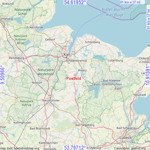
Postfeld GPS coordinates[2]
54° 12' 37.332" North, 10° 12' 46.008" East
| Map corner | latitude | longitude |
|---|---|---|
| Upper-left | 54.61952°, | 9.50966° |
| Center: | 54.21037°, | 10.21278° |
| Lower-right: | 53.79712°, | 10.91591° |
| Map W x H: | 91.4×91.4 km | = 56.8×56.8mi |
| max Lat: | 55.01917° ⇑4.7% North |
| Postfeld: | 54.21037° |
| min Lat: | ⇓95.3% South 47.40724° |
| min Long | Postfeld | max Long |
| 5.92978° | 10.21278° | 14.98853° |
| W 53.5%⇐ | ⇒46.5% E |
Elevation
Elevation of Postfeld is 34 m = 112 ft, and this is 215.1 m = 706 ft below average elevation for this country.
| Max E: |
1256 m = 4121 ft | 85.4% |
| Avg. | 249.1 m = 817 ft | |
| Postfeld | 34 m = 112 ft | |
Min E: |
-5 m = -16 ft | 14.6% |
See also: Germany elevation on elevation.city.
Geographical zone
Postfeld is located in North temperate zone (between Tropic of Cancer and the Arctic Circle). Distance of this North polar circle is 1373.5 km =853.5 mi to North.| Distance of | km | miles | from Postfeld |
|---|---|---|---|
| North Pole | 3979.4 | 2472.7 | to North |
| Arctic Circle | 1373.5 | 853.5 | to North |
| Tropic Cancer | 3421.7 | 2126.1 | to South |
| Equator | 6027.6 | 3745.4 | to South |


Nearby cities:
15 places around Postfeld: (largest is in red/bold)
• Barmissen
2.2 km =1.4 mi,  238°
238°
• Boksee
5.8 km =3.6 mi,  296°
296°
• Bothkamp
5.3 km =3.3 mi,  257°
257°
• Großbarkau
3.9 km =2.4 mi,  310°
310°
• Honigsee
3.2 km =2 mi,  323°
323°
• Kirchbarkau
4.5 km =2.8 mi,  270°
270°
• Klein Barkau
5.8 km =3.6 mi, 296°
• Kühren
3.3 km =2.1 mi,  112°
112°
• Löptin
3 km =1.9 mi,  175°
175°
• Nettelsee
4 km =2.5 mi,  199°
199°
• Pohnsdorf
4 km =2.5 mi,  35°
35°
• Preetz
5.1 km =3.2 mi,  56°
56°
• Schellhorn
5.7 km =3.5 mi,  68°
68°
• Wahlstorf (Dorf)
6.4 km =4 mi,  123°
123°
• Warnau
4.2 km =2.6 mi,  224°
224°
Sources, notices
• [Note1] Compared only with cities in Germany existing in our database
• [Src1] Map data: © OpenStreetMap contributors (CC-BY-SA)
• [Src2] Other city data from geonames.org with taken over terms of usage.
• [Src3] Geographical zone / Annual Mean Temperature by Robert A. Rohde @ Wikipedia
