Pölzig geodata
Pölzig (Thuringia) is a seat of a fourth-order administrative division; located in Germany in Europe/Berlin (GMT+2) time zone. With population of 1,395 people, there are 6088 cities with bigger population in this country. Compared to other cities in Germany, 57.1% of cities are located further ↓South; 84.6% of cities are located further ←West and 59.3% of cities have lower elevation than Pölzig. Note1


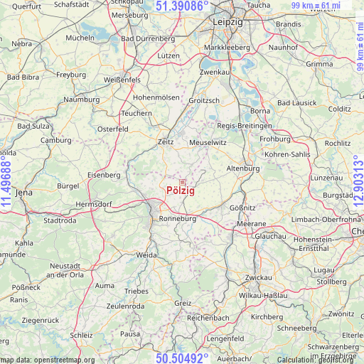
Pölzig GPS coordinates[2]
50° 57' 0" North, 12° 12' 0" East
| Map corner | latitude | longitude |
|---|---|---|
| Upper-left | 51.39086°, | 11.49688° |
| Center: | 50.95°, | 12.2° |
| Lower-right: | 50.50492°, | 12.90313° |
| Map W x H: | 98.5×98.5 km | = 61.2×61.2mi |
| max Lat: | 55.01917° ⇑42.9% North |
| Pölzig: | 50.95° |
| min Lat: | ⇓57.1% South 47.40724° |
| min Long | Pölzig | max Long |
| 5.92978° | 12.2° | 14.98853° |
| W 84.6%⇐ | ⇒15.4% E |
Elevation
Elevation of Pölzig is 285 m = 935 ft, and this is 35.9 m = 118 ft above average elevation for this country.
| Max E: |
1256 m = 4121 ft | 40.7% |
| Pölzig | 285 m 935 ft | |
| Avg. | 249.1 m = 817 ft | |
Min E: |
-5 m = -16 ft | 59.3% |
See also: Germany elevation on elevation.city.
Geographical zone
Pölzig is located in North temperate zone (between Tropic of Cancer and the Arctic Circle). Distance of this North polar circle is 1736.1 km =1078.8 mi to North.| Distance of | km | miles | from Pölzig |
|---|---|---|---|
| North Pole | 4342 | 2698 | to North |
| Arctic Circle | 1736.1 | 1078.8 | to North |
| Tropic Cancer | 3059.2 | 1900.9 | to South |
| Equator | 5665.1 | 3520.1 | to South |


Nearby cities:
15 places around Pölzig: (largest is in red/bold)
• Bethenhausen
2.3 km =1.4 mi,  180°
180°
• Brahmenau
4.1 km =2.5 mi,  224°
224°
• Dobitschen
5.7 km =3.5 mi,  81°
81°
• Geußnitz
7.5 km =4.7 mi,  351°
351°
• Großenstein
5.6 km =3.5 mi, 180°
• Hirschfeld
1.3 km =0.8 mi, 222°
• Kayna
5.6 km =3.5 mi,  27°
27°
• Korbussen
6.9 km =4.3 mi,  196°
196°
• Lumpzig
4.7 km =2.9 mi,  90°
90°
• Löbichau
7.7 km =4.8 mi,  144°
144°
• Schellbach
6.5 km =4 mi,  297°
297°
• Schwaara
6.5 km =4 mi, 217°
• Wildenbörten
6.9 km =4.3 mi,  122°
122°
• Wittgendorf
3.1 km =1.9 mi, 353°
• Würchwitz
7.9 km =4.9 mi,  14°
14°
Sources, notices
• [Note1] Compared only with cities in Germany existing in our database
• [Src1] Map data: © OpenStreetMap contributors (CC-BY-SA)
• [Src2] Other city data from geonames.org with taken over terms of usage.
• [Src3] Geographical zone / Annual Mean Temperature by Robert A. Rohde @ Wikipedia
