Polch geodata
Polch (Rheinland-Pfalz) is a populated place; located in Germany in Europe/Berlin (GMT+2) time zone. With population of 6,590 people, there are 2281 cities with bigger population in this country. Compared to other cities in Germany, 56.9% of cities are located further ↑North; 89.8% of cities are located further →East and 51.6% of cities have higher elevation than Polch. Note1
Administrative division(s):
- Level 1: Rheinland-Pfalz
- Level 3: Landkreis Mayen-Koblenz
- Level 4: Polch


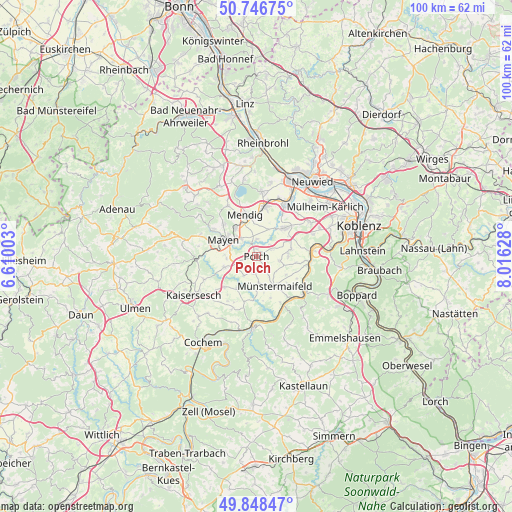
Polch GPS coordinates[2]
50° 17' 59.028" North, 7° 18' 47.34" East
| Map corner | latitude | longitude |
|---|---|---|
| Upper-left | 50.74675°, | 6.61003° |
| Center: | 50.29973°, | 7.31315° |
| Lower-right: | 49.84847°, | 8.01628° |
| Map W x H: | 99.9×99.9 km | = 62.1×62.1mi |
| max Lat: | 55.01917° ⇑56.9% North |
| Polch: | 50.29973° |
| min Lat: | ⇓43.1% South 47.40724° |
| min Long | Polch | max Long |
| 5.92978° | 7.31315° | 14.98853° |
| W 10.2%⇐ | ⇒89.8% E |
Elevation
Elevation of Polch is 214 m = 702 ft, and this is 35.1 m = 115 ft below average elevation for this country.
| Max E: |
1256 m = 4121 ft | 51.6% |
| Avg. | 249.1 m = 817 ft | |
| Polch | 214 m = 702 ft | |
Min E: |
-5 m = -16 ft | 48.4% |
See also: Germany elevation on elevation.city.
Geographical zone
Polch is located in North temperate zone (between Tropic of Cancer and the Arctic Circle). Distance of this North polar circle is 1808.4 km =1123.7 mi to North.| Distance of | km | miles | from Polch |
|---|---|---|---|
| North Pole | 4414.3 | 2742.9 | to North |
| Arctic Circle | 1808.4 | 1123.7 | to North |
| Tropic Cancer | 2986.9 | 1856 | to South |
| Equator | 5592.8 | 3475.2 | to South |


Nearby cities:
15 places around Polch: (largest is in red/bold)
• Einig
2.8 km =1.7 mi,  229°
229°
• Gappenach
3.7 km =2.3 mi,  142°
142°
• Gering
3.8 km =2.4 mi,  241°
241°
• Gierschnach
4.5 km =2.8 mi, 144°
• Kalt
6.8 km =4.2 mi,  121°
121°
• Kerben
4.2 km =2.6 mi,  63°
63°
• Kollig
4.2 km =2.6 mi,  209°
209°
• Lonnig
6.6 km =4.1 mi,  80°
80°
• Mertloch
3.4 km =2.1 mi,  186°
186°
• Münstermaifeld
6.9 km =4.3 mi,  149°
149°
• Naunheim
5.5 km =3.4 mi,  177°
177°
• Pillig
6.7 km =4.2 mi, 180°
• Rüber
3.8 km =2.4 mi,  89°
89°
• Trimbs
2.1 km =1.3 mi,  333°
333°
• Welling
3.7 km =2.3 mi,  3°
3°
Sources, notices
• [Note1] Compared only with cities in Germany existing in our database
• [Src1] Map data: © OpenStreetMap contributors (CC-BY-SA)
• [Src2] Other city data from geonames.org with taken over terms of usage.
• [Src3] Geographical zone / Annual Mean Temperature by Robert A. Rohde @ Wikipedia
