Naunheim geodata
Naunheim (Rheinland-Pfalz) is a seat of a fourth-order administrative division; located in Germany in Europe/Berlin (GMT+2) time zone. With population of 428 people, there are 9608 cities with bigger population in this country. Compared to other cities in Germany, 57.9% of cities are located further ↑North; 89.7% of cities are located further →East and 51.4% of cities have lower elevation than Naunheim. Note1
Administrative division(s):
- Level 1: Rheinland-Pfalz
- Level 3: Landkreis Mayen-Koblenz
- Level 4: Naunheim


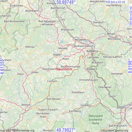
Naunheim GPS coordinates[2]
50° 15' 0" North, 7° 19' 0.012" East
| Map corner | latitude | longitude |
|---|---|---|
| Upper-left | 50.69749°, | 6.61355° |
| Center: | 50.25°, | 7.31667° |
| Lower-right: | 49.79827°, | 8.0198° |
| Map W x H: | 100×100 km | = 62.1×62.1mi |
| max Lat: | 55.01917° ⇑57.9% North |
| Naunheim: | 50.25° |
| min Lat: | ⇓42.1% South 47.40724° |
| min Long | Naunheim | max Long |
| 5.92978° | 7.31667° | 14.98853° |
| W 10.3%⇐ | ⇒89.7% E |
Elevation
Elevation of Naunheim is 236 m = 774 ft, and this is 13.1 m = 43 ft below average elevation for this country.
| Max E: |
1256 m = 4121 ft | 48.6% |
| Avg. | 249.1 m = 817 ft | |
| Naunheim | 236 m = 774 ft | |
Min E: |
-5 m = -16 ft | 51.4% |
See also: Germany elevation on elevation.city.
Geographical zone
Naunheim is located in North temperate zone (between Tropic of Cancer and the Arctic Circle). Distance of this North polar circle is 1813.9 km =1127.1 mi to North.| Distance of | km | miles | from Naunheim |
|---|---|---|---|
| North Pole | 4419.8 | 2746.3 | to North |
| Arctic Circle | 1813.9 | 1127.1 | to North |
| Tropic Cancer | 2981.4 | 1852.6 | to South |
| Equator | 5587.3 | 3471.8 | to South |


Nearby cities:
15 places around Naunheim: (largest is in red/bold)
• Brachtendorf
6.2 km =3.9 mi,  252°
252°
• Brohl
4.3 km =2.7 mi,  217°
217°
• Einig
4.4 km =2.7 mi,  327°
327°
• Gappenach
3.3 km =2.1 mi,  38°
38°
• Gering
5.1 km =3.2 mi,  316°
316°
• Gierschnach
3 km =1.9 mi,  51°
51°
• Kalt
5.9 km =3.7 mi,  70°
70°
• Kollig
3 km =1.9 mi,  308°
308°
• Mertloch
2.2 km =1.4 mi,  344°
344°
• Möntenich
3.4 km =2.1 mi,  201°
201°
• Münstermaifeld
3.3 km =2.1 mi,  97°
97°
• Pillig
1.3 km =0.8 mi, 196°
• Polch
5.5 km =3.4 mi,  357°
357°
• Roes
4.2 km =2.6 mi,  259°
259°
• Wierschem
3.7 km =2.3 mi,  137°
137°
Sources, notices
• [Note1] Compared only with cities in Germany existing in our database
• [Src1] Map data: © OpenStreetMap contributors (CC-BY-SA)
• [Src2] Other city data from geonames.org with taken over terms of usage.
• [Src3] Geographical zone / Annual Mean Temperature by Robert A. Rohde @ Wikipedia
