Burglahr geodata
Burglahr (Rheinland-Pfalz) is a seat of a fourth-order administrative division; located in Germany in Europe/Berlin (GMT+2) time zone. With population of 538 people, there are 9146 cities with bigger population in this country. Compared to other cities in Germany, 50% of cities are located further ↓South; 87.1% of cities are located further →East and 58.2% of cities have higher elevation than Burglahr. Note1
Administrative division(s):
- Level 1: Rheinland-Pfalz
- Level 3: Landkreis Altenkirchen
- Level 4: Burglahr


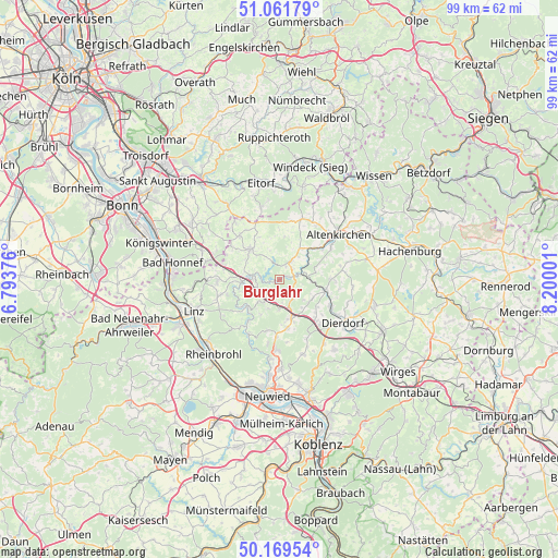
Burglahr GPS coordinates[2]
50° 37' 4.008" North, 7° 29' 48.768" East
| Map corner | latitude | longitude |
|---|---|---|
| Upper-left | 51.06179°, | 6.79376° |
| Center: | 50.61778°, | 7.49688° |
| Lower-right: | 50.16954°, | 8.20001° |
| Map W x H: | 99.2×99.2 km | = 61.6×61.6mi |
| max Lat: | 55.01917° ⇑50% North |
| Burglahr: | 50.61778° |
| min Lat: | ⇓50% South 47.40724° |
| min Long | Burglahr | max Long |
| 5.92978° | 7.49688° | 14.98853° |
| W 12.9%⇐ | ⇒87.1% E |
Elevation
Elevation of Burglahr is 166 m = 545 ft, and this is 83.1 m = 273 ft below average elevation for this country.
| Max E: |
1256 m = 4121 ft | 58.2% |
| Avg. | 249.1 m = 817 ft | |
| Burglahr | 166 m = 545 ft | |
Min E: |
-5 m = -16 ft | 41.8% |
See also: Germany elevation on elevation.city.
Geographical zone
Burglahr is located in North temperate zone (between Tropic of Cancer and the Arctic Circle). Distance of this North polar circle is 1773 km =1101.7 mi to North.| Distance of | km | miles | from Burglahr |
|---|---|---|---|
| North Pole | 4378.9 | 2720.9 | to North |
| Arctic Circle | 1773 | 1101.7 | to North |
| Tropic Cancer | 3022.3 | 1878 | to South |
| Equator | 5628.2 | 3497.2 | to South |


Nearby cities:
15 places around Burglahr: (largest is in red/bold)
• Bürdenbach
2 km =1.2 mi,  137°
137°
• Döttesfeld
3.7 km =2.3 mi,  80°
80°
• Eichen
3.1 km =1.9 mi,  56°
56°
• Eulenberg
2 km =1.2 mi,  228°
228°
• Flammersfeld
3.9 km =2.4 mi,  33°
33°
• Güllesheim
3.1 km =1.9 mi,  134°
134°
• Horhausen
4.1 km =2.5 mi,  145°
145°
• Krunkel
3.8 km =2.4 mi,  176°
176°
• Niedersteinebach
2.1 km =1.3 mi,  160°
160°
• Oberlahr
1.5 km =0.9 mi,  67°
67°
• Obersteinebach
3.9 km =2.4 mi,  194°
194°
• Peterslahr
2.1 km =1.3 mi,  266°
266°
• Pleckhausen
4.1 km =2.5 mi, 128°
• Reiferscheid
5.2 km =3.2 mi,  46°
46°
• Rott
2.2 km =1.4 mi,  38°
38°
Sources, notices
• [Note1] Compared only with cities in Germany existing in our database
• [Src1] Map data: © OpenStreetMap contributors (CC-BY-SA)
• [Src2] Other city data from geonames.org with taken over terms of usage.
• [Src3] Geographical zone / Annual Mean Temperature by Robert A. Rohde @ Wikipedia
