Planegg geodata
Planegg (Bavaria) is a seat of a fourth-order administrative division; located in Germany in Europe/Berlin (GMT+2) time zone. With population of 10,510 people, there are 1569 cities with bigger population in this country. Compared to other cities in Germany, 94% of cities are located further ↑North; 73.1% of cities are located further ←West and 92.3% of cities have lower elevation than Planegg. Note1
Administrative division(s):
- Level 1: Bavaria
- Level 2: Upper Bavaria
- Level 3: Landkreis München
- Level 4: Planegg


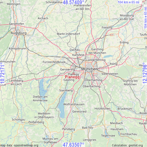
Planegg GPS coordinates[2]
48° 6' 24.192" North, 11° 25' 29.388" East
| Map corner | latitude | longitude |
|---|---|---|
| Upper-left | 48.57409°, | 10.72171° |
| Center: | 48.10672°, | 11.42483° |
| Lower-right: | 47.63507°, | 12.12796° |
| Map W x H: | 104.4×104.4 km | = 64.9×64.9mi |
| max Lat: | 55.01917° ⇑94% North |
| Planegg: | 48.10672° |
| min Lat: | ⇓6% South 47.40724° |
| min Long | Planegg | max Long |
| 5.92978° | 11.42483° | 14.98853° |
| W 73.1%⇐ | ⇒26.9% E |
Elevation
Elevation of Planegg is 547 m = 1795 ft, and this is 297.9 m = 977 ft above average elevation for this country.
| Max E: |
1256 m = 4121 ft | 7.7% |
| Planegg | 547 m 1795 ft | |
| Avg. | 249.1 m = 817 ft | |
Min E: |
-5 m = -16 ft | 92.3% |
See also: Germany elevation on elevation.city.
Geographical zone
Planegg is located in North temperate zone (between Tropic of Cancer and the Arctic Circle). Distance of this North polar circle is 2052.2 km =1275.2 mi to North.| Distance of | km | miles | from Planegg |
|---|---|---|---|
| North Pole | 4658.1 | 2894.4 | to North |
| Arctic Circle | 2052.2 | 1275.2 | to North |
| Tropic Cancer | 2743 | 1704.4 | to South |
| Equator | 5349 | 3323.7 | to South |


Nearby cities:
15 places around Planegg: (largest is in red/bold)
• Alling
9.9 km =6.2 mi,  292°
292°
• Baierbrunn
10.7 km =6.6 mi,  154°
154°
• Eichenau
10.4 km =6.5 mi,  309°
309°
• Gauting
5.5 km =3.4 mi,  220°
220°
• Germering
4.7 km =2.9 mi, 310°
• Gilching
9.7 km =6 mi,  270°
270°
• Gräfelfing
1.4 km =0.9 mi,  14°
14°
• Gröbenzell
11.2 km =7 mi,  337°
337°
• Grünwald
10.5 km =6.5 mi,  135°
135°
• Krailling
2 km =1.2 mi,  247°
247°
• Munich
11.7 km =7.3 mi,  73°
73°
• Neuried
3.4 km =2.1 mi,  116°
116°
• Pasing
4.5 km =2.8 mi,  30°
30°
• Puchheim
7.3 km =4.5 mi, 310°
• Pullach im Isartal
8.8 km =5.5 mi,  125°
125°
Sources, notices
• [Note1] Compared only with cities in Germany existing in our database
• [Src1] Map data: © OpenStreetMap contributors (CC-BY-SA)
• [Src2] Other city data from geonames.org with taken over terms of usage.
• [Src3] Geographical zone / Annual Mean Temperature by Robert A. Rohde @ Wikipedia
