Pasing geodata
Pasing (Bavaria) is a section of populated place; located in Germany in Europe/Berlin (GMT+2) time zone. With population of 35,728 people, there are 374 cities with bigger population in this country. Compared to other cities in Germany, 93.5% of cities are located further ↑North; 73.5% of cities are located further ←West and 91% of cities have lower elevation than Pasing. Note1
Administrative division(s):
- Level 1: Bavaria
- Level 2: Upper Bavaria
- Level 3: Kreisfreie Stadt München
- Level 4: München, Landeshauptstadt


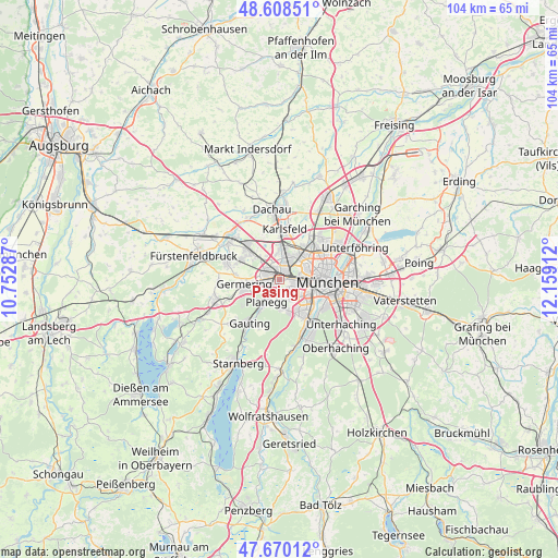
Pasing GPS coordinates[2]
48° 8' 29.256" North, 11° 27' 21.564" East
| Map corner | latitude | longitude |
|---|---|---|
| Upper-left | 48.60851°, | 10.75287° |
| Center: | 48.14146°, | 11.45599° |
| Lower-right: | 47.67012°, | 12.15912° |
| Map W x H: | 104.3×104.3 km | = 64.8×64.8mi |
| max Lat: | 55.01917° ⇑93.5% North |
| Pasing: | 48.14146° |
| min Lat: | ⇓6.5% South 47.40724° |
| min Long | Pasing | max Long |
| 5.92978° | 11.45599° | 14.98853° |
| W 73.5%⇐ | ⇒26.5% E |
Elevation
Elevation of Pasing is 527 m = 1729 ft, and this is 277.9 m = 912 ft above average elevation for this country.
| Max E: |
1256 m = 4121 ft | 9% |
| Pasing | 527 m 1729 ft | |
| Avg. | 249.1 m = 817 ft | |
Min E: |
-5 m = -16 ft | 91% |
See also: Germany elevation on elevation.city.
Geographical zone
Pasing is located in North temperate zone (between Tropic of Cancer and the Arctic Circle). Distance of this North polar circle is 2048.3 km =1272.8 mi to North.| Distance of | km | miles | from Pasing |
|---|---|---|---|
| North Pole | 4654.2 | 2892 | to North |
| Arctic Circle | 2048.3 | 1272.8 | to North |
| Tropic Cancer | 2746.9 | 1706.8 | to South |
| Equator | 5352.8 | 3326.1 | to South |


Nearby cities:
15 places around Pasing: (largest is in red/bold)
• Alling
11.5 km =7.1 mi,  269°
269°
• Bogenhausen
11.9 km =7.4 mi,  84°
84°
• Eichenau
10.7 km =6.6 mi,  285°
285°
• Gauting
9.9 km =6.2 mi,  216°
216°
• Germering
6 km =3.7 mi,  261°
261°
• Gräfelfing
3.2 km =2 mi, 218°
• Gröbenzell
9.3 km =5.8 mi,  314°
314°
• Karlsfeld
9.6 km =6 mi,  8°
8°
• Krailling
6.2 km =3.9 mi, 222°
• Munich
8.9 km =5.5 mi,  92°
92°
• Neuried
5.4 km =3.4 mi,  172°
172°
• Olching
11.2 km =7 mi, 305°
• Planegg
4.5 km =2.8 mi,  210°
210°
• Puchheim
7.9 km =4.9 mi,  276°
276°
• Pullach im Isartal
10.2 km =6.3 mi,  151°
151°
Sources, notices
• [Note1] Compared only with cities in Germany existing in our database
• [Src1] Map data: © OpenStreetMap contributors (CC-BY-SA)
• [Src2] Other city data from geonames.org with taken over terms of usage.
• [Src3] Geographical zone / Annual Mean Temperature by Robert A. Rohde @ Wikipedia
