Oyten geodata
Oyten (Lower Saxony) is a seat of a fourth-order administrative division; located in Germany in Europe/Berlin (GMT+2) time zone. With population of 15,286 people, there are 1045 cities with bigger population in this country. Compared to other cities in Germany, 82% of cities are located further ↓South; 65.2% of cities are located further →East and 88.9% of cities have higher elevation than Oyten. Note1


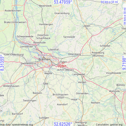
Oyten GPS coordinates[2]
53° 3' 0" North, 9° 1' 0.012" East
| Map corner | latitude | longitude |
|---|---|---|
| Upper-left | 53.47059°, | 8.31355° |
| Center: | 53.05°, | 9.01667° |
| Lower-right: | 52.62526°, | 9.7198° |
| Map W x H: | 94×94 km | = 58.4×58.4mi |
| max Lat: | 55.01917° ⇑18% North |
| Oyten: | 53.05° |
| min Lat: | ⇓82% South 47.40724° |
| min Long | Oyten | max Long |
| 5.92978° | 9.01667° | 14.98853° |
| W 34.8%⇐ | ⇒65.2% E |
Elevation
Elevation of Oyten is 24 m = 79 ft, and this is 225.1 m = 739 ft below average elevation for this country.
| Max E: |
1256 m = 4121 ft | 88.9% |
| Avg. | 249.1 m = 817 ft | |
| Oyten | 24 m = 79 ft | |
Min E: |
-5 m = -16 ft | 11.1% |
See also: Germany elevation on elevation.city.
Geographical zone
Oyten is located in North temperate zone (between Tropic of Cancer and the Arctic Circle). Distance of this North polar circle is 1502.6 km =933.7 mi to North.| Distance of | km | miles | from Oyten |
|---|---|---|---|
| North Pole | 4108.5 | 2552.9 | to North |
| Arctic Circle | 1502.6 | 933.7 | to North |
| Tropic Cancer | 3292.7 | 2046 | to South |
| Equator | 5898.6 | 3665.2 | to South |


Nearby cities:
15 places around Oyten: (largest is in red/bold)
• Achim
4 km =2.5 mi,  170°
170°
• Ahsen-Oetzen
11 km =6.8 mi,  157°
157°
• Bremen
14.2 km =8.8 mi,  281°
281°
• Emtinghausen
13.4 km =8.3 mi,  194°
194°
• Grasberg
15 km =9.3 mi,  351°
351°
• Hellwege
14.9 km =9.3 mi,  79°
79°
• Langwedel
13.8 km =8.6 mi,  125°
125°
• Lilienthal
12.7 km =7.9 mi,  323°
323°
• Morsum
11.5 km =7.1 mi, 158°
• Ottersberg
10.8 km =6.7 mi,  51°
51°
• Reeßum
16.3 km =10.1 mi,  55°
55°
• Riede
10.3 km =6.4 mi,  205°
205°
• Schwarme
16.7 km =10.4 mi,  180°
180°
• Sottrum
16.3 km =10.1 mi, 62°
• Thedinghausen
9.3 km =5.8 mi, 180°
Sources, notices
• [Note1] Compared only with cities in Germany existing in our database
• [Src1] Map data: © OpenStreetMap contributors (CC-BY-SA)
• [Src2] Other city data from geonames.org with taken over terms of usage.
• [Src3] Geographical zone / Annual Mean Temperature by Robert A. Rohde @ Wikipedia
