Oberweid geodata
Oberweid (Thuringia) is a seat of a fourth-order administrative division; located in Germany in Europe/Berlin (GMT+2) time zone. With population of 590 people, there are 8877 cities with bigger population in this country. Compared to other cities in Germany, 50.7% of cities are located further ↑North; 51.1% of cities are located further ←West and 88.4% of cities have lower elevation than Oberweid. Note1
Administrative division(s):
- Level 1: Thuringia
- Level 3: Landkreis Schmalkalden-Meiningen
- Level 4: Oberweid


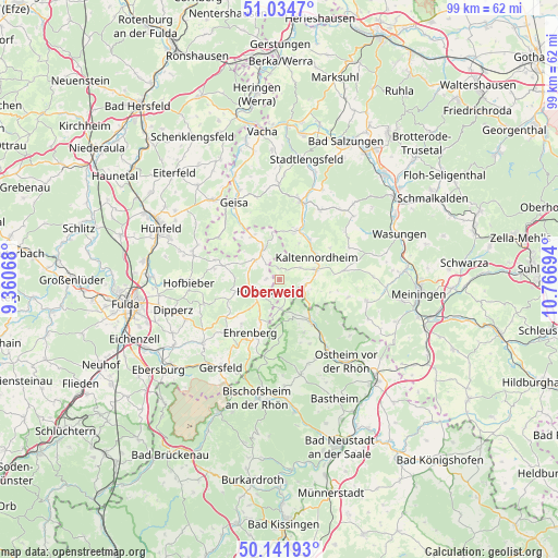
Oberweid GPS coordinates[2]
50° 35' 25.548" North, 10° 3' 49.716" East
| Map corner | latitude | longitude |
|---|---|---|
| Upper-left | 51.0347°, | 9.36068° |
| Center: | 50.59043°, | 10.06381° |
| Lower-right: | 50.14193°, | 10.76694° |
| Map W x H: | 99.3×99.3 km | = 61.7×61.7mi |
| max Lat: | 55.01917° ⇑50.7% North |
| Oberweid: | 50.59043° |
| min Lat: | ⇓49.3% South 47.40724° |
| min Long | Oberweid | max Long |
| 5.92978° | 10.06381° | 14.98853° |
| W 51.1%⇐ | ⇒48.9% E |
Elevation
Elevation of Oberweid is 498 m = 1634 ft, and this is 248.9 m = 817 ft above average elevation for this country.
| Max E: |
1256 m = 4121 ft | 11.6% |
| Oberweid | 498 m 1634 ft | |
| Avg. | 249.1 m = 817 ft | |
Min E: |
-5 m = -16 ft | 88.4% |
See also: Germany elevation on elevation.city.
Geographical zone
Oberweid is located in North temperate zone (between Tropic of Cancer and the Arctic Circle). Distance of this North polar circle is 1776 km =1103.6 mi to North.| Distance of | km | miles | from Oberweid |
|---|---|---|---|
| North Pole | 4381.9 | 2722.8 | to North |
| Arctic Circle | 1776 | 1103.6 | to North |
| Tropic Cancer | 3019.2 | 1876 | to South |
| Equator | 5625.1 | 3495.3 | to South |


Nearby cities:
15 places around Oberweid: (largest is in red/bold)
• Andenhausen
8.5 km =5.3 mi,  1°
1°
• Aschenhausen
9.7 km =6 mi,  83°
83°
• Birx
6.4 km =4 mi,  188°
188°
• Empfertshausen
8.9 km =5.5 mi,  16°
16°
• Erbenhausen
6.6 km =4.1 mi,  113°
113°
• Fladungen
9.7 km =6 mi,  143°
143°
• Frankenheim
5.1 km =3.2 mi,  176°
176°
• Hilders
4.8 km =3 mi,  244°
244°
• Kaltennordheim
7.8 km =4.8 mi,  59°
59°
• Kaltensundheim
6.8 km =4.2 mi,  74°
74°
• Kaltenwestheim
4.3 km =2.7 mi, 59°
• Klings
7.6 km =4.7 mi,  29°
29°
• Melpers
7.6 km =4.7 mi,  126°
126°
• Tann
6.5 km =4 mi,  334°
334°
• Unterweid
2.2 km =1.4 mi,  354°
354°
Sources, notices
• [Note1] Compared only with cities in Germany existing in our database
• [Src1] Map data: © OpenStreetMap contributors (CC-BY-SA)
• [Src2] Other city data from geonames.org with taken over terms of usage.
• [Src3] Geographical zone / Annual Mean Temperature by Robert A. Rohde @ Wikipedia
