Empfertshausen geodata
Empfertshausen (Thuringia) is a seat of a fourth-order administrative division; located in Germany in Europe/Berlin (GMT+2) time zone. With population of 663 people, there are 8503 cities with bigger population in this country. Compared to other cities in Germany, 51.1% of cities are located further ↓South; 51.6% of cities are located further ←West and 81.9% of cities have lower elevation than Empfertshausen. Note1


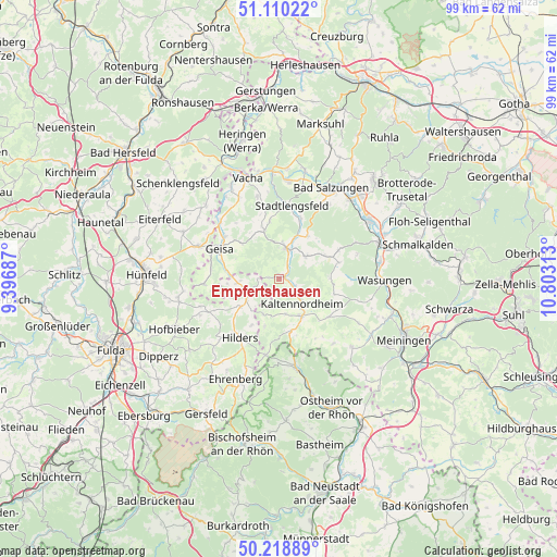
Empfertshausen GPS coordinates[2]
50° 40' 0.012" North, 10° 6' 0" East
| Map corner | latitude | longitude |
|---|---|---|
| Upper-left | 51.11022°, | 9.39687° |
| Center: | 50.66667°, | 10.1° |
| Lower-right: | 50.21889°, | 10.80313° |
| Map W x H: | 99.1×99.1 km | = 61.6×61.6mi |
| max Lat: | 55.01917° ⇑48.9% North |
| Empfertshausen: | 50.66667° |
| min Lat: | ⇓51.1% South 47.40724° |
| min Long | Empfertshausen | max Long |
| 5.92978° | 10.1° | 14.98853° |
| W 51.6%⇐ | ⇒48.4% E |
Elevation
Elevation of Empfertshausen is 445 m = 1460 ft, and this is 195.9 m = 643 ft above average elevation for this country.
| Max E: |
1256 m = 4121 ft | 18.1% |
| Empfertshausen | 445 m 1460 ft | |
| Avg. | 249.1 m = 817 ft | |
Min E: |
-5 m = -16 ft | 81.9% |
See also: Germany elevation on elevation.city.
Geographical zone
Empfertshausen is located in North temperate zone (between Tropic of Cancer and the Arctic Circle). Distance of this North polar circle is 1767.6 km =1098.3 mi to North.| Distance of | km | miles | from Empfertshausen |
|---|---|---|---|
| North Pole | 4373.5 | 2717.6 | to North |
| Arctic Circle | 1767.6 | 1098.3 | to North |
| Tropic Cancer | 3027.7 | 1881.3 | to South |
| Equator | 5633.6 | 3500.6 | to South |


Nearby cities:
15 places around Empfertshausen: (largest is in red/bold)
• Andenhausen
2.3 km =1.4 mi,  270°
270°
• Dermbach
5.4 km =3.4 mi,  13°
13°
• Kaltenlengsfeld
7.1 km =4.4 mi,  113°
113°
• Kaltennordheim
6.1 km =3.8 mi,  136°
136°
• Kaltensundheim
7.8 km =4.8 mi,  149°
149°
• Kaltenwestheim
6.4 km =4 mi,  169°
169°
• Klings
2.2 km =1.4 mi, 147°
• Neidhartshausen
3 km =1.9 mi,  51°
51°
• Oberweid
8.9 km =5.5 mi,  196°
196°
• Oechsen
9.1 km =5.7 mi,  343°
343°
• Roßdorf
9 km =5.6 mi,  65°
65°
• Tann
6 km =3.7 mi,  243°
243°
• Unterweid
6.9 km =4.3 mi, 203°
• Urnshausen
9.2 km =5.7 mi,  34°
34°
• Wiesenthal
6 km =3.7 mi, 51°
Sources, notices
• [Note1] Compared only with cities in Germany existing in our database
• [Src1] Map data: © OpenStreetMap contributors (CC-BY-SA)
• [Src2] Other city data from geonames.org with taken over terms of usage.
• [Src3] Geographical zone / Annual Mean Temperature by Robert A. Rohde @ Wikipedia
