Antdorf geodata
Antdorf (Bavaria) is a seat of a fourth-order administrative division; located in Germany in Europe/Berlin (GMT+2) time zone. With population of 1,106 people, there are 6831 cities with bigger population in this country. Compared to other cities in Germany, 98.2% of cities are located further ↑North; 71.4% of cities are located further ←West and 95.9% of cities have lower elevation than Antdorf. Note1
Administrative division(s):
- Level 1: Bavaria
- Level 2: Upper Bavaria
- Level 3: Landkreis Weilheim-Schongau
- Level 4: Antdorf


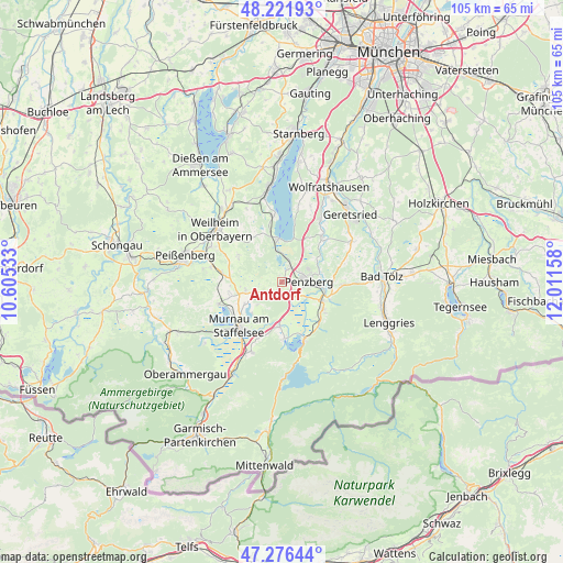
Antdorf GPS coordinates[2]
47° 45' 4.788" North, 11° 18' 30.42" East
| Map corner | latitude | longitude |
|---|---|---|
| Upper-left | 48.22193°, | 10.60533° |
| Center: | 47.75133°, | 11.30845° |
| Lower-right: | 47.27644°, | 12.01158° |
| Map W x H: | 105.1×105.1 km | = 65.3×65.3mi |
| max Lat: | 55.01917° ⇑98.2% North |
| Antdorf: | 47.75133° |
| min Lat: | ⇓1.8% South 47.40724° |
| min Long | Antdorf | max Long |
| 5.92978° | 11.30845° | 14.98853° |
| W 71.4%⇐ | ⇒28.6% E |
Elevation
Elevation of Antdorf is 624 m = 2047 ft, and this is 374.9 m = 1230 ft above average elevation for this country.
| Max E: |
1256 m = 4121 ft | 4.1% |
| Antdorf | 624 m 2047 ft | |
| Avg. | 249.1 m = 817 ft | |
Min E: |
-5 m = -16 ft | 95.9% |
See also: Germany elevation on elevation.city.
Geographical zone
Antdorf is located in North temperate zone (between Tropic of Cancer and the Arctic Circle). Distance of this North polar circle is 2091.7 km =1299.7 mi to North.| Distance of | km | miles | from Antdorf |
|---|---|---|---|
| North Pole | 4697.6 | 2919 | to North |
| Arctic Circle | 2091.7 | 1299.7 | to North |
| Tropic Cancer | 2703.5 | 1679.9 | to South |
| Equator | 5309.5 | 3299.2 | to South |


Nearby cities:
15 places around Antdorf: (largest is in red/bold)
• Benediktbeuern
9.4 km =5.8 mi,  122°
122°
• Bichl
8.5 km =5.3 mi,  114°
114°
• Eglfing
9.6 km =6 mi,  257°
257°
• Großweil
8.4 km =5.2 mi,  183°
183°
• Habach
2.7 km =1.7 mi,  223°
223°
• Huglfing
10.7 km =6.6 mi,  279°
279°
• Iffeldorf
1.8 km =1.1 mi,  19°
19°
• Kochel
11.2 km =7 mi,  156°
156°
• Obersöchering
7.1 km =4.4 mi,  253°
253°
• Penzberg
5.1 km =3.2 mi,  88°
88°
• Riegsee
8.1 km =5 mi, 223°
• Schlehdorf
10.4 km =6.5 mi, 177°
• Seeshaupt
8.2 km =5.1 mi,  356°
356°
• Sindelsdorf
3.5 km =2.2 mi,  148°
148°
• Spatzenhausen
9 km =5.6 mi,  244°
244°
Sources, notices
• [Note1] Compared only with cities in Germany existing in our database
• [Src1] Map data: © OpenStreetMap contributors (CC-BY-SA)
• [Src2] Other city data from geonames.org with taken over terms of usage.
• [Src3] Geographical zone / Annual Mean Temperature by Robert A. Rohde @ Wikipedia
