Oberndorf geodata
Oberndorf (Baden-Württemberg) is a populated place; located in Germany in Europe/Berlin (GMT+2) time zone. With population of 14,740 people, there are 1079 cities with bigger population in this country. Compared to other cities in Germany, 91.3% of cities are located further ↑North; 70.4% of cities are located further →East and 89.7% of cities have lower elevation than Oberndorf. Note1
Administrative division(s):
- Level 1: Baden-Württemberg
- Level 2: Freiburg Region
- Level 3: Landkreis Rottweil
- Level 4: Oberndorf am Neckar


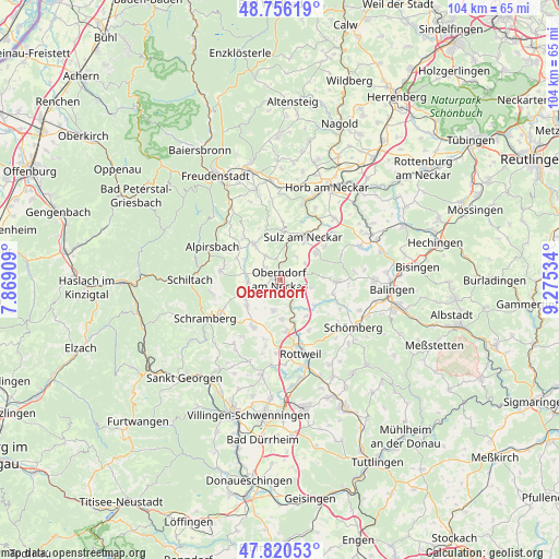
Oberndorf GPS coordinates[2]
48° 17' 25.8" North, 8° 34' 19.956" East
| Map corner | latitude | longitude |
|---|---|---|
| Upper-left | 48.75619°, | 7.86909° |
| Center: | 48.2905°, | 8.57221° |
| Lower-right: | 47.82053°, | 9.27534° |
| Map W x H: | 104×104 km | = 64.6×64.6mi |
| max Lat: | 55.01917° ⇑91.3% North |
| Oberndorf: | 48.2905° |
| min Lat: | ⇓8.7% South 47.40724° |
| min Long | Oberndorf | max Long |
| 5.92978° | 8.57221° | 14.98853° |
| W 29.6%⇐ | ⇒70.4% E |
Elevation
Elevation of Oberndorf is 510 m = 1673 ft, and this is 260.9 m = 856 ft above average elevation for this country.
| Max E: |
1256 m = 4121 ft | 10.3% |
| Oberndorf | 510 m 1673 ft | |
| Avg. | 249.1 m = 817 ft | |
Min E: |
-5 m = -16 ft | 89.7% |
See also: Germany elevation on elevation.city.
Geographical zone
Oberndorf is located in North temperate zone (between Tropic of Cancer and the Arctic Circle). Distance of this North polar circle is 2031.8 km =1262.5 mi to North.| Distance of | km | miles | from Oberndorf |
|---|---|---|---|
| North Pole | 4637.7 | 2881.7 | to North |
| Arctic Circle | 2031.8 | 1262.5 | to North |
| Tropic Cancer | 2763.5 | 1717.2 | to South |
| Equator | 5369.4 | 3336.4 | to South |


Nearby cities:
15 places around Oberndorf: (largest is in red/bold)
• Aichhalden
12.8 km =8 mi,  258°
258°
• Bösingen
6.6 km =4.1 mi,  194°
194°
• Dautmergen
13.6 km =8.5 mi,  113°
113°
• Dietingen
11.1 km =6.9 mi,  149°
149°
• Dornhan
8.1 km =5 mi,  324°
324°
• Dunningen
10 km =6.2 mi,  209°
209°
• Epfendorf
5 km =3.1 mi,  155°
155°
• Mühlheim am Bach
13.5 km =8.4 mi,  43°
43°
• Rosenfeld
11.2 km =7 mi,  92°
92°
• Seedorf
7.6 km =4.7 mi,  232°
232°
• Sulz am Neckar
9.2 km =5.7 mi,  29°
29°
• Villingendorf
10.1 km =6.3 mi,  175°
175°
• Vöhringen
8.4 km =5.2 mi,  54°
54°
• Zimmern ob Rottweil
13.9 km =8.6 mi,  173°
173°
• Zimmern unter der Burg
13.4 km =8.3 mi,  125°
125°
Sources, notices
• [Note1] Compared only with cities in Germany existing in our database
• [Src1] Map data: © OpenStreetMap contributors (CC-BY-SA)
• [Src2] Other city data from geonames.org with taken over terms of usage.
• [Src3] Geographical zone / Annual Mean Temperature by Robert A. Rohde @ Wikipedia
