Aichhalden geodata
Aichhalden (Baden-Württemberg) is a seat of a fourth-order administrative division; located in Germany in Europe/Berlin (GMT+2) time zone. With population of 4,184 people, there are 3183 cities with bigger population in this country. Compared to other cities in Germany, 91.7% of cities are located further ↑North; 71.9% of cities are located further →East and 98% of cities have lower elevation than Aichhalden. Note1
Administrative division(s):
- Level 1: Baden-Württemberg
- Level 2: Freiburg Region
- Level 3: Landkreis Rottweil
- Level 4: Aichhalden


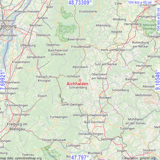
Aichhalden GPS coordinates[2]
48° 16' 1.884" North, 8° 24' 8.388" East
| Map corner | latitude | longitude |
|---|---|---|
| Upper-left | 48.73309°, | 7.69921° |
| Center: | 48.26719°, | 8.40233° |
| Lower-right: | 47.797°, | 9.10546° |
| Map W x H: | 104.1×104.1 km | = 64.7×64.7mi |
| max Lat: | 55.01917° ⇑91.7% North |
| Aichhalden: | 48.26719° |
| min Lat: | ⇓8.3% South 47.40724° |
| min Long | Aichhalden | max Long |
| 5.92978° | 8.40233° | 14.98853° |
| W 28.1%⇐ | ⇒71.9% E |
Elevation
Elevation of Aichhalden is 705 m = 2313 ft, and this is 455.9 m = 1496 ft above average elevation for this country.
| Max E: |
1256 m = 4121 ft | 2% |
| Aichhalden | 705 m 2313 ft | |
| Avg. | 249.1 m = 817 ft | |
Min E: |
-5 m = -16 ft | 98% |
See also: Germany elevation on elevation.city.
Geographical zone
Aichhalden is located in North temperate zone (between Tropic of Cancer and the Arctic Circle). Distance of this North polar circle is 2034.4 km =1264.1 mi to North.| Distance of | km | miles | from Aichhalden |
|---|---|---|---|
| North Pole | 4640.3 | 2883.3 | to North |
| Arctic Circle | 2034.4 | 1264.1 | to North |
| Tropic Cancer | 2760.9 | 1715.5 | to South |
| Equator | 5366.8 | 3334.8 | to South |


Nearby cities:
15 places around Aichhalden: (largest is in red/bold)
• Alpirsbach
8.7 km =5.4 mi,  359°
359°
• Bösingen
11.6 km =7.2 mi,  109°
109°
• Dornhan
12.1 km =7.5 mi,  40°
40°
• Dunningen
9.8 km =6.1 mi,  128°
128°
• Gutach
14.2 km =8.8 mi,  261°
261°
• Hardt
9.4 km =5.8 mi,  173°
173°
• Hornberg
14 km =8.7 mi,  243°
243°
• Lauterbach/Schwarzwald
6.1 km =3.8 mi,  227°
227°
• Oberndorf
12.8 km =8 mi,  78°
78°
• Schenkenzell
5.5 km =3.4 mi,  335°
335°
• Schiltach
5.1 km =3.2 mi,  298°
298°
• Schramberg
5 km =3.1 mi,  194°
194°
• Seedorf
6.8 km =4.2 mi, 107°
• Tennenbronn
9.3 km =5.8 mi,  203°
203°
• Wolfach
14.1 km =8.8 mi,  281°
281°
Sources, notices
• [Note1] Compared only with cities in Germany existing in our database
• [Src1] Map data: © OpenStreetMap contributors (CC-BY-SA)
• [Src2] Other city data from geonames.org with taken over terms of usage.
• [Src3] Geographical zone / Annual Mean Temperature by Robert A. Rohde @ Wikipedia
