Vöhringen geodata
Vöhringen (Baden-Württemberg) is a seat of a fourth-order administrative division; located in Germany in Europe/Berlin (GMT+2) time zone. With population of 4,183 people, there are 3184 cities with bigger population in this country. Compared to other cities in Germany, 90.8% of cities are located further ↑North; 69.5% of cities are located further →East and 89.4% of cities have lower elevation than Vöhringen. Note1
Administrative division(s):
- Level 1: Baden-Württemberg
- Level 2: Freiburg Region
- Level 3: Landkreis Rottweil
- Level 4: Vöhringen


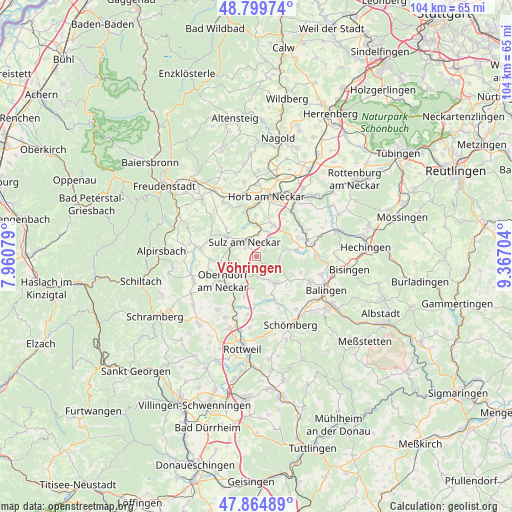
Vöhringen GPS coordinates[2]
48° 20' 4.056" North, 8° 39' 50.112" East
| Map corner | latitude | longitude |
|---|---|---|
| Upper-left | 48.79974°, | 7.96079° |
| Center: | 48.33446°, | 8.66392° |
| Lower-right: | 47.86489°, | 9.36704° |
| Map W x H: | 103.9×103.9 km | = 64.6×64.6mi |
| max Lat: | 55.01917° ⇑90.8% North |
| Vöhringen: | 48.33446° |
| min Lat: | ⇓9.2% South 47.40724° |
| min Long | Vöhringen | max Long |
| 5.92978° | 8.66392° | 14.98853° |
| W 30.5%⇐ | ⇒69.5% E |
Elevation
Elevation of Vöhringen is 507 m = 1663 ft, and this is 257.9 m = 846 ft above average elevation for this country.
| Max E: |
1256 m = 4121 ft | 10.6% |
| Vöhringen | 507 m 1663 ft | |
| Avg. | 249.1 m = 817 ft | |
Min E: |
-5 m = -16 ft | 89.4% |
See also: Germany elevation on elevation.city.
Geographical zone
Vöhringen is located in North temperate zone (between Tropic of Cancer and the Arctic Circle). Distance of this North polar circle is 2026.9 km =1259.5 mi to North.| Distance of | km | miles | from Vöhringen |
|---|---|---|---|
| North Pole | 4632.8 | 2878.7 | to North |
| Arctic Circle | 2026.9 | 1259.5 | to North |
| Tropic Cancer | 2768.4 | 1720.2 | to South |
| Equator | 5374.3 | 3339.4 | to South |


Nearby cities:
15 places around Vöhringen: (largest is in red/bold)
• Bösingen
14.1 km =8.8 mi,  216°
216°
• Dautmergen
11.8 km =7.3 mi,  150°
150°
• Dietingen
14.5 km =9 mi,  184°
184°
• Dormettingen
13.5 km =8.4 mi,  143°
143°
• Dornhan
11.6 km =7.2 mi,  278°
278°
• Empfingen
7.3 km =4.5 mi,  27°
27°
• Epfendorf
10.5 km =6.5 mi,  206°
206°
• Geislingen
12.2 km =7.6 mi,  115°
115°
• Haigerloch
10.9 km =6.8 mi,  71°
71°
• Horb am Neckar
12.4 km =7.7 mi,  9°
9°
• Mühlheim am Bach
5.5 km =3.4 mi, 26°
• Oberndorf
8.4 km =5.2 mi,  234°
234°
• Rosenfeld
6.9 km =4.3 mi, 140°
• Sulz am Neckar
3.9 km =2.4 mi,  323°
323°
• Zimmern unter der Burg
13.3 km =8.3 mi,  162°
162°
Sources, notices
• [Note1] Compared only with cities in Germany existing in our database
• [Src1] Map data: © OpenStreetMap contributors (CC-BY-SA)
• [Src2] Other city data from geonames.org with taken over terms of usage.
• [Src3] Geographical zone / Annual Mean Temperature by Robert A. Rohde @ Wikipedia
