Mühlheim am Bach geodata
Mühlheim am Bach (Baden-Württemberg) is a populated place; located in Germany in Europe/Berlin (GMT+2) time zone. With population of 3,476 people, there are 3629 cities with bigger population in this country. Compared to other cities in Germany, 90.5% of cities are located further ↑North; 69.1% of cities are located further →East and 79.1% of cities have lower elevation than Mühlheim am Bach. Note1
Administrative division(s):
- Level 1: Baden-Württemberg
- Level 2: Freiburg Region
- Level 3: Landkreis Rottweil
- Level 4: Sulz am Neckar


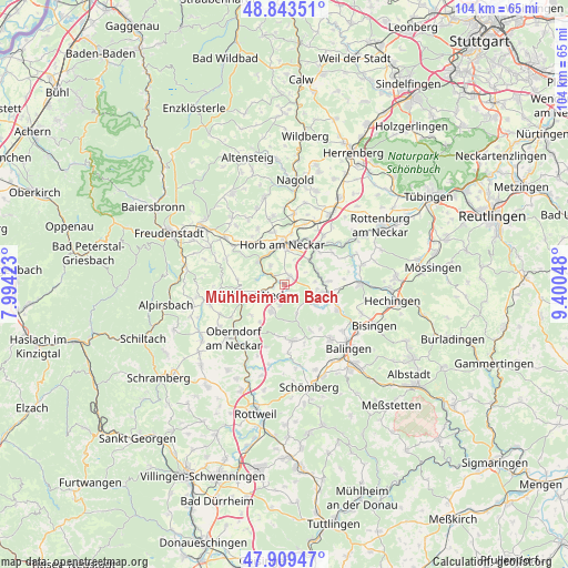
Mühlheim am Bach GPS coordinates[2]
48° 22' 43.068" North, 8° 41' 50.46" East
| Map corner | latitude | longitude |
|---|---|---|
| Upper-left | 48.84351°, | 7.99423° |
| Center: | 48.37863°, | 8.69735° |
| Lower-right: | 47.90947°, | 9.40048° |
| Map W x H: | 103.9×103.9 km | = 64.6×64.6mi |
| max Lat: | 55.01917° ⇑90.5% North |
| Mühlheim am Bach: | 48.37863° |
| min Lat: | ⇓9.5% South 47.40724° |
| min Long | Mühlheim am Ba | max Long |
| 5.92978° | 8.69735° | 14.98853° |
| W 30.9%⇐ | ⇒69.1% E |
Elevation
Elevation of Mühlheim am Bach is 428 m = 1404 ft, and this is 178.9 m = 587 ft above average elevation for this country.
| Max E: |
1256 m = 4121 ft | 20.9% |
| Mühlheim am Bach | 428 m 1404 ft | |
| Avg. | 249.1 m = 817 ft | |
Min E: |
-5 m = -16 ft | 79.1% |
See also: Germany elevation on elevation.city.
Geographical zone
Mühlheim am Bach is located in North temperate zone (between Tropic of Cancer and the Arctic Circle). Distance of this North polar circle is 2022 km =1256.4 mi to North.| Distance of | km | miles | from Mühlheim am Bach |
|---|---|---|---|
| North Pole | 4627.9 | 2875.6 | to North |
| Arctic Circle | 2022 | 1256.4 | to North |
| Tropic Cancer | 2773.3 | 1723.2 | to South |
| Equator | 5379.2 | 3342.5 | to South |


Nearby cities:
15 places around Mühlheim am Bach: (largest is in red/bold)
• Dautmergen
15.5 km =9.6 mi,  167°
167°
• Dornhan
14.3 km =8.9 mi,  257°
257°
• Empfingen
1.8 km =1.1 mi,  31°
31°
• Geislingen
13.2 km =8.2 mi,  139°
139°
• Glatten
15.5 km =9.6 mi,  297°
297°
• Grosselfingen
14.9 km =9.3 mi,  110°
110°
• Haigerloch
8 km =5 mi,  100°
100°
• Hirrlingen
14.5 km =9 mi,  74°
74°
• Horb am Neckar
7.3 km =4.5 mi,  356°
356°
• Oberndorf
13.5 km =8.4 mi,  223°
223°
• Rangendingen
14.2 km =8.8 mi,  88°
88°
• Rosenfeld
10.4 km =6.5 mi, 169°
• Schopfloch
13.7 km =8.5 mi,  308°
308°
• Sulz am Neckar
5.1 km =3.2 mi,  249°
249°
• Vöhringen
5.5 km =3.4 mi,  206°
206°
Sources, notices
• [Note1] Compared only with cities in Germany existing in our database
• [Src1] Map data: © OpenStreetMap contributors (CC-BY-SA)
• [Src2] Other city data from geonames.org with taken over terms of usage.
• [Src3] Geographical zone / Annual Mean Temperature by Robert A. Rohde @ Wikipedia
