Nostorf geodata
Nostorf (Mecklenburg-Vorpommern) is a populated place; located in Germany in Europe/Berlin (GMT+2) time zone. With population of 1,081 people, there are 6907 cities with bigger population in this country. Compared to other cities in Germany, 84.6% of cities are located further ↓South; 61.7% of cities are located further ←West and 93.1% of cities have higher elevation than Nostorf. Note1
Administrative division(s):
- Level 1: Mecklenburg-Vorpommern
- Level 3: Ludwigslust-Parchim
- Level 4: Nostorf


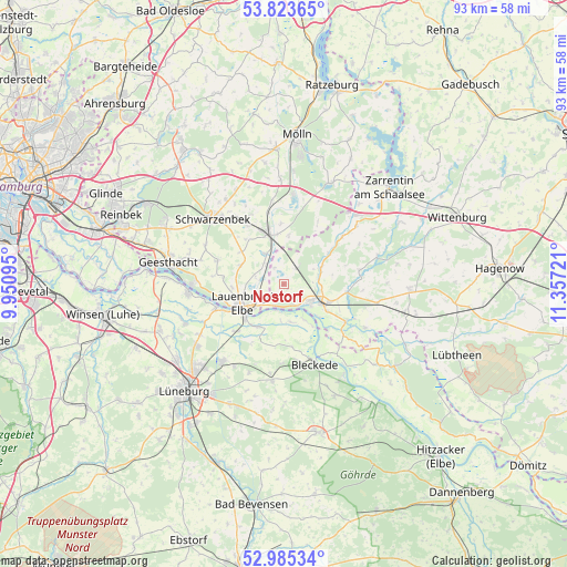
Nostorf GPS coordinates[2]
53° 24' 23.616" North, 10° 39' 14.688" East
| Map corner | latitude | longitude |
|---|---|---|
| Upper-left | 53.82365°, | 9.95095° |
| Center: | 53.40656°, | 10.65408° |
| Lower-right: | 52.98534°, | 11.35721° |
| Map W x H: | 93.2×93.2 km | = 57.9×57.9mi |
| max Lat: | 55.01917° ⇑15.4% North |
| Nostorf: | 53.40656° |
| min Lat: | ⇓84.6% South 47.40724° |
| min Long | Nostorf | max Long |
| 5.92978° | 10.65408° | 14.98853° |
| W 61.7%⇐ | ⇒38.3% E |
Elevation
Elevation of Nostorf is 13 m = 43 ft, and this is 236.1 m = 775 ft below average elevation for this country.
| Max E: |
1256 m = 4121 ft | 93.1% |
| Avg. | 249.1 m = 817 ft | |
| Nostorf | 13 m = 43 ft | |
Min E: |
-5 m = -16 ft | 6.9% |
See also: Germany elevation on elevation.city.
Geographical zone
Nostorf is located in North temperate zone (between Tropic of Cancer and the Arctic Circle). Distance of this North polar circle is 1462.9 km =909 mi to North.| Distance of | km | miles | from Nostorf |
|---|---|---|---|
| North Pole | 4068.8 | 2528.2 | to North |
| Arctic Circle | 1462.9 | 909 | to North |
| Tropic Cancer | 3332.3 | 2070.6 | to South |
| Equator | 5938.3 | 3689.9 | to South |


Nearby cities:
15 places around Nostorf: (largest is in red/bold)
• Basedow
4.8 km =3 mi,  283°
283°
• Boizenburg
5.4 km =3.4 mi,  121°
121°
• Bröthen
8.2 km =5.1 mi,  6°
6°
• Buchhorst
6.3 km =3.9 mi,  248°
248°
• Büchen
8.5 km =5.3 mi,  343°
343°
• Dalldorf
4.2 km =2.6 mi,  318°
318°
• Gresse
6.6 km =4.1 mi,  67°
67°
• Hittbergen
8.1 km =5 mi,  211°
211°
• Krüzen
8 km =5 mi,  264°
264°
• Lanze
3.9 km =2.4 mi,  236°
236°
• Lauenburg
7.5 km =4.7 mi, 239°
• Lütau
7.5 km =4.7 mi,  293°
293°
• Schwanheide
3.2 km =2 mi,  37°
37°
• Wangelau
8.4 km =5.2 mi,  305°
305°
• Witzeeze
5.9 km =3.7 mi,  328°
328°
Sources, notices
• [Note1] Compared only with cities in Germany existing in our database
• [Src1] Map data: © OpenStreetMap contributors (CC-BY-SA)
• [Src2] Other city data from geonames.org with taken over terms of usage.
• [Src3] Geographical zone / Annual Mean Temperature by Robert A. Rohde @ Wikipedia
