Schwanheide geodata
Schwanheide (Mecklenburg-Vorpommern) is a populated place; located in Germany in Europe/Berlin (GMT+2) time zone. With population of 760 people, there are 8050 cities with bigger population in this country. Compared to other cities in Germany, 84.8% of cities are located further ↓South; 62.2% of cities are located further ←West and 91.6% of cities have higher elevation than Schwanheide. Note1
Administrative division(s):
- Level 1: Mecklenburg-Vorpommern
- Level 3: Ludwigslust-Parchim
- Level 4: Schwanheide


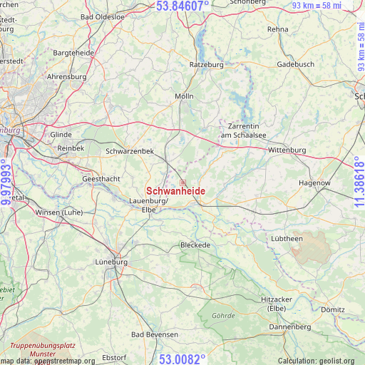
Schwanheide GPS coordinates[2]
53° 25' 45.12" North, 10° 40' 58.98" East
| Map corner | latitude | longitude |
|---|---|---|
| Upper-left | 53.84607°, | 9.97993° |
| Center: | 53.4292°, | 10.68305° |
| Lower-right: | 53.0082°, | 11.38618° |
| Map W x H: | 93.2×93.2 km | = 57.9×57.9mi |
| max Lat: | 55.01917° ⇑15.2% North |
| Schwanheide: | 53.4292° |
| min Lat: | ⇓84.8% South 47.40724° |
| min Long | Schwanheide | max Long |
| 5.92978° | 10.68305° | 14.98853° |
| W 62.2%⇐ | ⇒37.8% E |
Elevation
Elevation of Schwanheide is 17 m = 56 ft, and this is 232.1 m = 761 ft below average elevation for this country.
| Max E: |
1256 m = 4121 ft | 91.6% |
| Avg. | 249.1 m = 817 ft | |
| Schwanheide | 17 m = 56 ft | |
Min E: |
-5 m = -16 ft | 8.4% |
See also: Germany elevation on elevation.city.
Geographical zone
Schwanheide is located in North temperate zone (between Tropic of Cancer and the Arctic Circle). Distance of this North polar circle is 1460.4 km =907.5 mi to North.| Distance of | km | miles | from Schwanheide |
|---|---|---|---|
| North Pole | 4066.3 | 2526.7 | to North |
| Arctic Circle | 1460.4 | 907.5 | to North |
| Tropic Cancer | 3334.9 | 2072.2 | to South |
| Equator | 5940.8 | 3691.4 | to South |


Nearby cities:
15 places around Schwanheide: (largest is in red/bold)
• Basedow
6.8 km =4.2 mi,  258°
258°
• Boizenburg
5.9 km =3.7 mi,  153°
153°
• Bröthen
5.7 km =3.5 mi,  349°
349°
• Buchhorst
9.2 km =5.7 mi,  238°
238°
• Büchen
7.1 km =4.4 mi,  322°
322°
• Dalldorf
4.8 km =3 mi,  277°
277°
• Fitzen
7.7 km =4.8 mi,  341°
341°
• Gresse
4.2 km =2.6 mi,  90°
90°
• Langenlehsten
8.8 km =5.5 mi,  25°
25°
• Lanze
7 km =4.3 mi,  227°
227°
• Lütau
8.8 km =5.5 mi,  272°
272°
• Neu Gülze
8.9 km =5.5 mi,  128°
128°
• Nostorf
3.2 km =2 mi,  217°
217°
• Wangelau
9.1 km =5.7 mi, 284°
• Witzeeze
5.6 km =3.5 mi,  296°
296°
Sources, notices
• [Note1] Compared only with cities in Germany existing in our database
• [Src1] Map data: © OpenStreetMap contributors (CC-BY-SA)
• [Src2] Other city data from geonames.org with taken over terms of usage.
• [Src3] Geographical zone / Annual Mean Temperature by Robert A. Rohde @ Wikipedia
