Bad Münster am Stein-Ebernburg geodata
Bad Münster am Stein-Ebernburg (Rheinland-Pfalz) is a section of populated place; located in Germany in Europe/Berlin (GMT+2) time zone. With population of 3,940 people, there are 3328 cities with bigger population in this country. Compared to other cities in Germany, 68.7% of cities are located further ↑North; 80.1% of cities are located further →East and 64.2% of cities have higher elevation than Bad Münster am Stein-Ebernburg. Note1
Administrative division(s):
- Level 1: Rheinland-Pfalz
- Level 3: Landkreis Bad Kreuznach
- Level 4: Bad Kreuznach
Current local time in Bad Münster am Stein-Ebernburg:
05:15 PM, TuesdayDifference from your time zone: hours


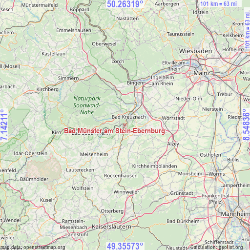
Bad Münster am Stein-Ebernburg GPS coordinates[2]
49° 48' 41.724" North, 7° 50' 42.828" East
| Map corner | latitude | longitude |
|---|---|---|
| Upper-left | 50.26319°, | 7.14211° |
| Center: | 49.81159°, | 7.84523° |
| Lower-right: | 49.35573°, | 8.54836° |
| Map W x H: | 100.9×100.9 km | = 62.7×62.7mi |
| max Lat: | 55.01917° ⇑68.7% North |
| Bad Münster am Stein-Ebernburg: | 49.81159° |
| min Lat: | ⇓31.3% South 47.40724° |
| min Long | Bad Münster am | max Long |
| 5.92978° | 7.84523° | 14.98853° |
| W 19.9%⇐ | ⇒80.1% E |
Elevation
Elevation of Bad Münster am Stein-Ebernburg is 125 m = 410 ft, and this is 124.1 m = 407 ft below average elevation for this country.
| Max E: |
1256 m = 4121 ft | 64.2% |
| Avg. | 249.1 m = 817 ft | |
| Bad Münster am Stein-Ebernburg | 125 m = 410 ft | |
Min E: |
-5 m = -16 ft | 35.8% |
See also: Germany elevation on elevation.city.
Geographical zone
Bad Münster am Stein-Ebernburg is located in North temperate zone (between Tropic of Cancer and the Arctic Circle). Distance of this North polar circle is 1862.6 km =1157.4 mi to North.| Distance of | km | miles | from Bad Münster am Stein-Ebernburg |
|---|---|---|---|
| North Pole | 4468.5 | 2776.6 | to North |
| Arctic Circle | 1862.6 | 1157.4 | to North |
| Tropic Cancer | 2932.6 | 1822.2 | to South |
| Equator | 5538.5 | 3441.5 | to South |


Nearby cities:
15 places around Bad Münster am Stein-Ebernburg: (largest is in red/bold)
• Altenbamberg
3.3 km =2.1 mi,  195°
195°
• Bad Kreuznach
3.7 km =2.3 mi,  25°
25°
• Feilbingert
6 km =3.7 mi,  213°
213°
• Frei-Laubersheim
4.1 km =2.5 mi,  108°
108°
• Fürfeld
5.1 km =3.2 mi,  138°
138°
• Hackenheim
4.2 km =2.6 mi,  68°
68°
• Hargesheim
5.8 km =3.6 mi,  348°
348°
• Hochstätten
5.1 km =3.2 mi,  189°
189°
• Hüffelsheim
3.3 km =2.1 mi,  279°
279°
• Neu-Bamberg
5.8 km =3.6 mi,  104°
104°
• Niederhausen
4.6 km =2.9 mi,  253°
253°
• Norheim
2.2 km =1.4 mi,  268°
268°
• Rüdesheim
4.4 km =2.7 mi,  329°
329°
• Traisen
2.1 km =1.3 mi,  285°
285°
• Weinsheim
6.1 km =3.8 mi, 293°
Sources, notices
• [Note1] Compared only with cities in Germany existing in our database
• [Src1] Map data: © OpenStreetMap contributors (CC-BY-SA)
• [Src2] Other city data from geonames.org with taken over terms of usage.
• [Src3] Geographical zone / Annual Mean Temperature by Robert A. Rohde @ Wikipedia
