Norddorf geodata
Norddorf (Schleswig-Holstein) is a seat of a fourth-order administrative division; located in Germany in Europe/Berlin (GMT+2) time zone. With population of 651 people, there are 8551 cities with bigger population in this country. Compared to other cities in Germany, 99% of cities are located further ↓South; 72.7% of cities are located further →East and 94.3% of cities have higher elevation than Norddorf. Note1
Administrative division(s):
- Level 1: Schleswig-Holstein
- Level 3: Kreis Nordfriesland
- Level 4: Norddorf auf Amrum


Norddorf GPS coordinates[2]
54° 40' 46.884" North, 8° 19' 58.656" East
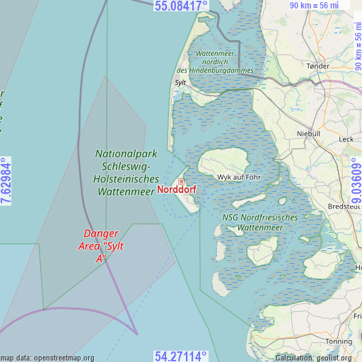
| Map corner | latitude | longitude |
|---|---|---|
| Upper-left | 55.08417°, | 7.62984° |
| Center: | 54.67969°, | 8.33296° |
| Lower-right: | 54.27114°, | 9.03609° |
| Map W x H: | 90.4×90.4 km | = 56.2×56.2mi |
| max Lat: | 55.01917° ⇑1% North |
| Norddorf: | 54.67969° |
| min Lat: | ⇓99% South 47.40724° |
| min Long | Norddorf | max Long |
| 5.92978° | 8.33296° | 14.98853° |
| W 27.3%⇐ | ⇒72.7% E |
Elevation
Elevation of Norddorf is 10 m = 33 ft, and this is 239.1 m = 784 ft below average elevation for this country.
| Max E: |
1256 m = 4121 ft | 94.3% |
| Avg. | 249.1 m = 817 ft | |
| Norddorf | 10 m = 33 ft | |
Min E: |
-5 m = -16 ft | 5.7% |
See also: Germany elevation on elevation.city.
Geographical zone
Norddorf is located in North temperate zone (between Tropic of Cancer and the Arctic Circle). Distance of this North polar circle is 1321.4 km =821.1 mi to North.| Distance of | km | miles | from Norddorf |
|---|---|---|---|
| North Pole | 3927.3 | 2440.3 | to North |
| Arctic Circle | 1321.4 | 821.1 | to North |
| Tropic Cancer | 3473.9 | 2158.6 | to South |
| Equator | 6079.8 | 3777.8 | to South |


Nearby cities:
15 places around Norddorf: (largest is in red/bold)
• Alkersum
11.8 km =7.3 mi,  74°
74°
• Borgsum
8.3 km =5.2 mi, 73°
• Dunsum
8.2 km =5.1 mi,  45°
45°
• Hörnum
9.1 km =5.7 mi,  341°
341°
• Midlum
12.7 km =7.9 mi, 72°
• Nebel
3.5 km =2.2 mi,  157°
157°
• Nieblum
10.2 km =6.3 mi,  82°
82°
• Oevenum
13.2 km =8.2 mi, 75°
• Oldsum
9.2 km =5.7 mi, 51°
• Süderende
8.5 km =5.3 mi, 52°
• Utersum
6.1 km =3.8 mi, 50°
• Witsum
7.3 km =4.5 mi, 72°
• Wittdün
6.9 km =4.3 mi,  148°
148°
• Wrixum
14 km =8.7 mi, 80°
• Wyk auf Föhr
15.1 km =9.4 mi,  85°
85°
Sources, notices
• [Note1] Compared only with cities in Germany existing in our database
• [Src1] Map data: © OpenStreetMap contributors (CC-BY-SA)
• [Src2] Other city data from geonames.org with taken over terms of usage.
• [Src3] Geographical zone / Annual Mean Temperature by Robert A. Rohde @ Wikipedia
