Dunsum geodata
Dunsum (Schleswig-Holstein) is a seat of a fourth-order administrative division; located in Germany in Europe/Berlin (GMT+2) time zone. With population of 94 people, there are 10857 cities with bigger population in this country. Compared to other cities in Germany, 99.4% of cities are located further ↓South; 71.7% of cities are located further →East and 97.6% of cities have higher elevation than Dunsum. Note1
Administrative division(s):
- Level 1: Schleswig-Holstein
- Level 3: Kreis Nordfriesland
- Level 4: Dunsum


Dunsum GPS coordinates[2]
54° 43' 52.536" North, 8° 25' 29.568" East
| Map corner | latitude | longitude |
|---|---|---|
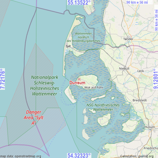
| Upper-left | 55.13522°, | 7.72176° |
| Center: | 54.73126°, | 8.42488° |
| Lower-right: | 54.32323°, | 9.12801° |
| Map W x H: | 90.3×90.3 km | = 56.1×56.1mi |
| max Lat: | 55.01917° ⇑0.6% North |
| Dunsum: | 54.73126° |
| min Lat: | ⇓99.4% South 47.40724° |
| min Long | Dunsum | max Long |
| 5.92978° | 8.42488° | 14.98853° |
| W 28.3%⇐ | ⇒71.7% E |
Elevation
Elevation of Dunsum is 3 m = 10 ft, and this is 246.1 m = 807 ft below average elevation for this country.
| Max E: |
1256 m = 4121 ft | 97.6% |
| Avg. | 249.1 m = 817 ft | |
| Dunsum | 3 m = 10 ft | |
Min E: |
-5 m = -16 ft | 2.4% |
See also: Germany elevation on elevation.city.
Geographical zone
Dunsum is located in North temperate zone (between Tropic of Cancer and the Arctic Circle). Distance of this North polar circle is 1315.6 km =817.5 mi to North.| Distance of | km | miles | from Dunsum |
|---|---|---|---|
| North Pole | 3921.5 | 2436.7 | to North |
| Arctic Circle | 1315.6 | 817.5 | to North |
| Tropic Cancer | 3479.6 | 2162.1 | to South |
| Equator | 6085.5 | 3781.4 | to South |


Nearby cities:
15 places around Dunsum: (largest is in red/bold)
• Alkersum
6 km =3.7 mi,  115°
115°
• Borgsum
4 km =2.5 mi,  148°
148°
• Hörnum
9.2 km =5.7 mi,  288°
288°
• Midlum
6.5 km =4 mi,  106°
106°
• Nebel
10 km =6.2 mi,  207°
207°
• Nieblum
6.1 km =3.8 mi,  135°
135°
• Norddorf
8.2 km =5.1 mi,  225°
225°
• Oevenum
7.2 km =4.5 mi, 108°
• Oldsum
1.3 km =0.8 mi,  91°
91°
• Süderende
1 km =0.6 mi, 123°
• Utersum
2.2 km =1.4 mi, 212°
• Witsum
3.7 km =2.3 mi,  164°
164°
• Wittdün
11.8 km =7.3 mi,  191°
191°
• Wrixum
8.7 km =5.4 mi, 113°
• Wyk auf Föhr
10.1 km =6.3 mi, 115°
Sources, notices
• [Note1] Compared only with cities in Germany existing in our database
• [Src1] Map data: © OpenStreetMap contributors (CC-BY-SA)
• [Src2] Other city data from geonames.org with taken over terms of usage.
• [Src3] Geographical zone / Annual Mean Temperature by Robert A. Rohde @ Wikipedia
