Nierstein geodata
Nierstein (Rheinland-Pfalz) is a seat of a fourth-order administrative division; located in Germany in Europe/Berlin (GMT+2) time zone. With population of 7,729 people, there are 2001 cities with bigger population in this country. Compared to other cities in Germany, 67.2% of cities are located further ↑North; 72.6% of cities are located further →East and 68.3% of cities have higher elevation than Nierstein. Note1
Administrative division(s):
- Level 1: Rheinland-Pfalz
- Level 3: Landkreis Mainz-Bingen
- Level 4: Nierstein


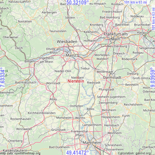
Nierstein GPS coordinates[2]
49° 52' 12.108" North, 8° 20' 11.292" East
| Map corner | latitude | longitude |
|---|---|---|
| Upper-left | 50.32109°, | 7.63334° |
| Center: | 49.87003°, | 8.33647° |
| Lower-right: | 49.41472°, | 9.03959° |
| Map W x H: | 100.8×100.8 km | = 62.6×62.6mi |
| max Lat: | 55.01917° ⇑67.2% North |
| Nierstein: | 49.87003° |
| min Lat: | ⇓32.8% South 47.40724° |
| min Long | Nierstein | max Long |
| 5.92978° | 8.33647° | 14.98853° |
| W 27.4%⇐ | ⇒72.6% E |
Elevation
Elevation of Nierstein is 101 m = 331 ft, and this is 148.1 m = 486 ft below average elevation for this country.
| Max E: |
1256 m = 4121 ft | 68.3% |
| Avg. | 249.1 m = 817 ft | |
| Nierstein | 101 m = 331 ft | |
Min E: |
-5 m = -16 ft | 31.7% |
See also: Germany elevation on elevation.city.
Geographical zone
Nierstein is located in North temperate zone (between Tropic of Cancer and the Arctic Circle). Distance of this North polar circle is 1856.1 km =1153.3 mi to North.| Distance of | km | miles | from Nierstein |
|---|---|---|---|
| North Pole | 4462 | 2772.6 | to North |
| Arctic Circle | 1856.1 | 1153.3 | to North |
| Tropic Cancer | 2939.1 | 1826.3 | to South |
| Equator | 5545 | 3445.5 | to South |


Nearby cities:
15 places around Nierstein: (largest is in red/bold)
• Bodenheim
7.4 km =4.6 mi,  350°
350°
• Dalheim
5.7 km =3.5 mi,  211°
211°
• Dexheim
2.9 km =1.8 mi, 209°
• Dienheim
3.8 km =2.4 mi,  165°
165°
• Friesenheim
6.8 km =4.2 mi,  236°
236°
• Gau-Bischofsheim
6.8 km =4.2 mi,  318°
318°
• Hahnheim
7.2 km =4.5 mi,  261°
261°
• Harxheim
6.5 km =4 mi,  307°
307°
• Köngernheim
7 km =4.3 mi,  247°
247°
• Ludwigshöhe
6 km =3.7 mi,  175°
175°
• Lörzweiler
4.3 km =2.7 mi, 316°
• Mommenheim
5.2 km =3.2 mi,  282°
282°
• Nackenheim
5 km =3.1 mi,  1°
1°
• Oppenheim
2.4 km =1.5 mi,  135°
135°
• Selzen
5.9 km =3.7 mi, 259°
Sources, notices
• [Note1] Compared only with cities in Germany existing in our database
• [Src1] Map data: © OpenStreetMap contributors (CC-BY-SA)
• [Src2] Other city data from geonames.org with taken over terms of usage.
• [Src3] Geographical zone / Annual Mean Temperature by Robert A. Rohde @ Wikipedia
