Dexheim geodata
Dexheim (Rheinland-Pfalz) is a seat of a fourth-order administrative division; located in Germany in Europe/Berlin (GMT+2) time zone. With population of 1,547 people, there are 5787 cities with bigger population in this country. Compared to other cities in Germany, 67.8% of cities are located further ↑North; 72.8% of cities are located further →East and 59.8% of cities have higher elevation than Dexheim. Note1
Administrative division(s):
- Level 1: Rheinland-Pfalz
- Level 3: Landkreis Mainz-Bingen
- Level 4: Dexheim


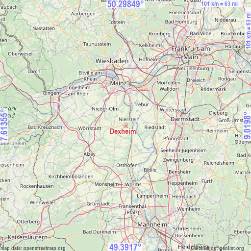
Dexheim GPS coordinates[2]
49° 50' 49.992" North, 8° 19' 0.012" East
| Map corner | latitude | longitude |
|---|---|---|
| Upper-left | 50.29849°, | 7.61355° |
| Center: | 49.84722°, | 8.31667° |
| Lower-right: | 49.3917°, | 9.0198° |
| Map W x H: | 100.8×100.8 km | = 62.6×62.6mi |
| max Lat: | 55.01917° ⇑67.8% North |
| Dexheim: | 49.84722° |
| min Lat: | ⇓32.2% South 47.40724° |
| min Long | Dexheim | max Long |
| 5.92978° | 8.31667° | 14.98853° |
| W 27.2%⇐ | ⇒72.8% E |
Elevation
Elevation of Dexheim is 154 m = 505 ft, and this is 95.1 m = 312 ft below average elevation for this country.
| Max E: |
1256 m = 4121 ft | 59.8% |
| Avg. | 249.1 m = 817 ft | |
| Dexheim | 154 m = 505 ft | |
Min E: |
-5 m = -16 ft | 40.2% |
See also: Germany elevation on elevation.city.
Geographical zone
Dexheim is located in North temperate zone (between Tropic of Cancer and the Arctic Circle). Distance of this North polar circle is 1858.7 km =1154.9 mi to North.| Distance of | km | miles | from Dexheim |
|---|---|---|---|
| North Pole | 4464.6 | 2774.2 | to North |
| Arctic Circle | 1858.7 | 1154.9 | to North |
| Tropic Cancer | 2936.6 | 1824.7 | to South |
| Equator | 5542.5 | 3443.9 | to South |


Nearby cities:
15 places around Dexheim: (largest is in red/bold)
• Dalheim
2.8 km =1.7 mi,  213°
213°
• Dienheim
2.6 km =1.6 mi,  115°
115°
• Eimsheim
6 km =3.7 mi,  198°
198°
• Friesenheim
4.4 km =2.7 mi,  254°
254°
• Guntersblum
5.9 km =3.7 mi,  159°
159°
• Hahnheim
5.9 km =3.7 mi,  284°
284°
• Köngernheim
5 km =3.1 mi,  268°
268°
• Ludwigshöhe
3.9 km =2.4 mi,  150°
150°
• Lörzweiler
5.9 km =3.7 mi,  344°
344°
• Mommenheim
5.2 km =3.2 mi,  314°
314°
• Nierstein
2.9 km =1.8 mi,  29°
29°
• Oppenheim
3.2 km =2 mi,  74°
74°
• Selzen
4.6 km =2.9 mi,  288°
288°
• Uelversheim
4.6 km =2.9 mi, 205°
• Weinolsheim
4.7 km =2.9 mi,  222°
222°
Sources, notices
• [Note1] Compared only with cities in Germany existing in our database
• [Src1] Map data: © OpenStreetMap contributors (CC-BY-SA)
• [Src2] Other city data from geonames.org with taken over terms of usage.
• [Src3] Geographical zone / Annual Mean Temperature by Robert A. Rohde @ Wikipedia
