Neunkhausen geodata
Neunkhausen (Rheinland-Pfalz) is a seat of a fourth-order administrative division; located in Germany in Europe/Berlin (GMT+2) time zone. With population of 1,148 people, there are 6704 cities with bigger population in this country. Compared to other cities in Germany, 52.3% of cities are located further ↓South; 78.8% of cities are located further →East and 83% of cities have lower elevation than Neunkhausen. Note1


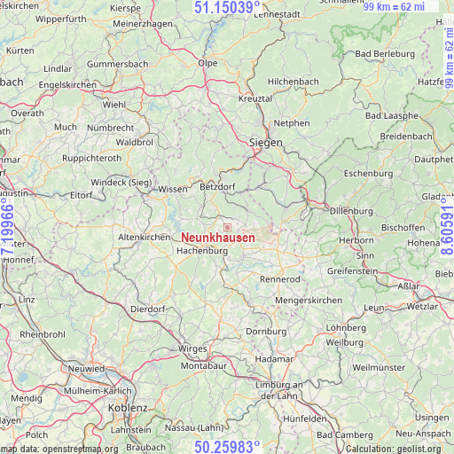
Neunkhausen GPS coordinates[2]
50° 42' 25.992" North, 7° 54' 10.008" East
| Map corner | latitude | longitude |
|---|---|---|
| Upper-left | 51.15039°, | 7.19966° |
| Center: | 50.70722°, | 7.90278° |
| Lower-right: | 50.25983°, | 8.60591° |
| Map W x H: | 99×99 km | = 61.5×61.5mi |
| max Lat: | 55.01917° ⇑47.7% North |
| Neunkhausen: | 50.70722° |
| min Lat: | ⇓52.3% South 47.40724° |
| min Long | Neunkhausen | max Long |
| 5.92978° | 7.90278° | 14.98853° |
| W 21.2%⇐ | ⇒78.8% E |
Elevation
Elevation of Neunkhausen is 453 m = 1486 ft, and this is 203.9 m = 669 ft above average elevation for this country.
| Max E: |
1256 m = 4121 ft | 17% |
| Neunkhausen | 453 m 1486 ft | |
| Avg. | 249.1 m = 817 ft | |
Min E: |
-5 m = -16 ft | 83% |
See also: Germany elevation on elevation.city.
Geographical zone
Neunkhausen is located in North temperate zone (between Tropic of Cancer and the Arctic Circle). Distance of this North polar circle is 1763.1 km =1095.5 mi to North.| Distance of | km | miles | from Neunkhausen |
|---|---|---|---|
| North Pole | 4368.9 | 2714.7 | to North |
| Arctic Circle | 1763.1 | 1095.5 | to North |
| Tropic Cancer | 3032.2 | 1884.1 | to South |
| Equator | 5638.1 | 3503.4 | to South |


Nearby cities:
15 places around Neunkhausen: (largest is in red/bold)
• Bölsberg
4.6 km =2.9 mi,  167°
167°
• Dickendorf
4.7 km =2.9 mi,  308°
308°
• Elkenroth
3.2 km =2 mi,  334°
334°
• Friedewald
4.1 km =2.5 mi,  83°
83°
• Kausen
4.5 km =2.8 mi, 326°
• Kirburg
3.4 km =2.1 mi,  140°
140°
• Langenbach bei Kirburg
2.3 km =1.4 mi,  110°
110°
• Luckenbach
5 km =3.1 mi,  260°
260°
• Mörlen
1.6 km =1 mi,  231°
231°
• Nauroth
2.1 km =1.3 mi,  245°
245°
• Niederdreisbach
4.9 km =3 mi,  17°
17°
• Norken
3.8 km =2.4 mi,  185°
185°
• Rosenheim
3.7 km =2.3 mi,  278°
278°
• Schutzbach
4.8 km =3 mi,  357°
357°
• Weitefeld
2.7 km =1.7 mi,  41°
41°
Sources, notices
• [Note1] Compared only with cities in Germany existing in our database
• [Src1] Map data: © OpenStreetMap contributors (CC-BY-SA)
• [Src2] Other city data from geonames.org with taken over terms of usage.
• [Src3] Geographical zone / Annual Mean Temperature by Robert A. Rohde @ Wikipedia
