Dickendorf geodata
Dickendorf (Rheinland-Pfalz) is a seat of a fourth-order administrative division; located in Germany in Europe/Berlin (GMT+2) time zone. With population of 375 people, there are 9771 cities with bigger population in this country. Compared to other cities in Germany, 52.8% of cities are located further ↓South; 80.1% of cities are located further →East and 70.6% of cities have lower elevation than Dickendorf. Note1
Administrative division(s):
- Level 1: Rheinland-Pfalz
- Level 3: Landkreis Altenkirchen
- Level 4: Dickendorf


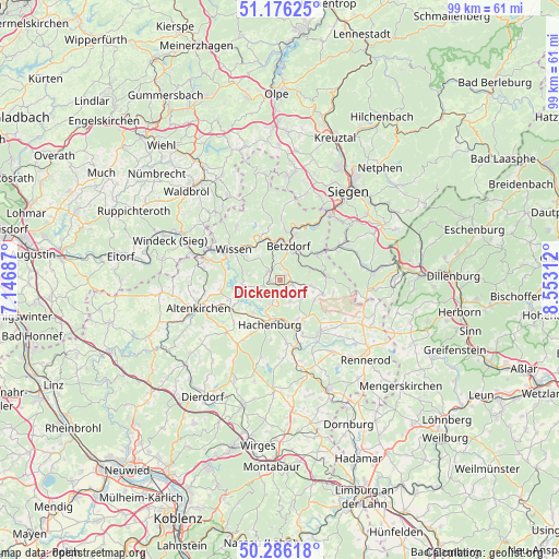
Dickendorf GPS coordinates[2]
50° 43' 59.988" North, 7° 51' 0" East
| Map corner | latitude | longitude |
|---|---|---|
| Upper-left | 51.17625°, | 7.14687° |
| Center: | 50.73333°, | 7.85° |
| Lower-right: | 50.28618°, | 8.55312° |
| Map W x H: | 99×99 km | = 61.5×61.5mi |
| max Lat: | 55.01917° ⇑47.2% North |
| Dickendorf: | 50.73333° |
| min Lat: | ⇓52.8% South 47.40724° |
| min Long | Dickendorf | max Long |
| 5.92978° | 7.85° | 14.98853° |
| W 19.9%⇐ | ⇒80.1% E |
Elevation
Elevation of Dickendorf is 363 m = 1191 ft, and this is 113.9 m = 374 ft above average elevation for this country.
| Max E: |
1256 m = 4121 ft | 29.4% |
| Dickendorf | 363 m 1191 ft | |
| Avg. | 249.1 m = 817 ft | |
Min E: |
-5 m = -16 ft | 70.6% |
See also: Germany elevation on elevation.city.
Geographical zone
Dickendorf is located in North temperate zone (between Tropic of Cancer and the Arctic Circle). Distance of this North polar circle is 1760.2 km =1093.7 mi to North.| Distance of | km | miles | from Dickendorf |
|---|---|---|---|
| North Pole | 4366 | 2712.9 | to North |
| Arctic Circle | 1760.2 | 1093.7 | to North |
| Tropic Cancer | 3035.1 | 1885.9 | to South |
| Equator | 5641 | 3505.2 | to South |


Nearby cities:
15 places around Dickendorf: (largest is in red/bold)
• Atzelgift
3.9 km =2.4 mi,  197°
197°
• Elben
2.2 km =1.4 mi,  327°
327°
• Elkenroth
2.3 km =1.4 mi,  90°
90°
• Gebhardshain
3 km =1.9 mi,  308°
308°
• Kausen
1.5 km =0.9 mi,  53°
53°
• Kundert
4.4 km =2.7 mi,  248°
248°
• Luckenbach
3.9 km =2.4 mi, 197°
• Molzhain
1.9 km =1.2 mi,  0°
0°
• Mörlen
4.6 km =2.9 mi,  148°
148°
• Mörsbach
4.8 km =3 mi,  261°
261°
• Nauroth
4.2 km =2.6 mi, 154°
• Neunkhausen
4.7 km =2.9 mi,  128°
128°
• Rosenheim
2.3 km =1.4 mi,  178°
178°
• Schutzbach
4 km =2.5 mi,  62°
62°
• Steineroth
3 km =1.9 mi,  5°
5°
Sources, notices
• [Note1] Compared only with cities in Germany existing in our database
• [Src1] Map data: © OpenStreetMap contributors (CC-BY-SA)
• [Src2] Other city data from geonames.org with taken over terms of usage.
• [Src3] Geographical zone / Annual Mean Temperature by Robert A. Rohde @ Wikipedia
