Nauroth geodata
Nauroth (Rheinland-Pfalz) is a seat of a fourth-order administrative division; located in Germany in Europe/Berlin (GMT+2) time zone. With population of 1,183 people, there are 6609 cities with bigger population in this country. Compared to other cities in Germany, 52% of cities are located further ↓South; 79.4% of cities are located further →East and 80.5% of cities have lower elevation than Nauroth. Note1
Administrative division(s):
- Level 1: Rheinland-Pfalz
- Level 3: Landkreis Altenkirchen
- Level 4: Nauroth


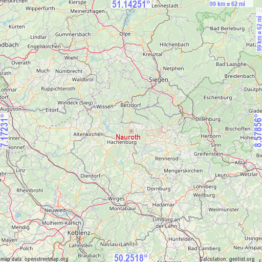
Nauroth GPS coordinates[2]
50° 41' 57.372" North, 7° 52' 31.548" East
| Map corner | latitude | longitude |
|---|---|---|
| Upper-left | 51.14251°, | 7.17231° |
| Center: | 50.69927°, | 7.87543° |
| Lower-right: | 50.2518°, | 8.57856° |
| Map W x H: | 99×99 km | = 61.5×61.5mi |
| max Lat: | 55.01917° ⇑48% North |
| Nauroth: | 50.69927° |
| min Lat: | ⇓52% South 47.40724° |
| min Long | Nauroth | max Long |
| 5.92978° | 7.87543° | 14.98853° |
| W 20.6%⇐ | ⇒79.4% E |
Elevation
Elevation of Nauroth is 436 m = 1430 ft, and this is 186.9 m = 613 ft above average elevation for this country.
| Max E: |
1256 m = 4121 ft | 19.5% |
| Nauroth | 436 m 1430 ft | |
| Avg. | 249.1 m = 817 ft | |
Min E: |
-5 m = -16 ft | 80.5% |
See also: Germany elevation on elevation.city.
Geographical zone
Nauroth is located in North temperate zone (between Tropic of Cancer and the Arctic Circle). Distance of this North polar circle is 1763.9 km =1096 mi to North.| Distance of | km | miles | from Nauroth |
|---|---|---|---|
| North Pole | 4369.8 | 2715.3 | to North |
| Arctic Circle | 1763.9 | 1096 | to North |
| Tropic Cancer | 3031.3 | 1883.6 | to South |
| Equator | 5637.2 | 3502.8 | to South |


Nearby cities:
15 places around Nauroth: (largest is in red/bold)
• Atzelgift
3 km =1.9 mi,  271°
271°
• Bölsberg
4.6 km =2.9 mi,  141°
141°
• Dickendorf
4.2 km =2.6 mi,  334°
334°
• Elkenroth
3.8 km =2.4 mi,  8°
8°
• Kausen
4.7 km =2.9 mi,  353°
353°
• Kirburg
4.4 km =2.7 mi,  113°
113°
• Langenbach bei Kirburg
4.1 km =2.5 mi,  88°
88°
• Luckenbach
3 km =1.9 mi, 271°
• Mörlen
0.6 km =0.4 mi,  101°
101°
• Neunkhausen
2.1 km =1.3 mi,  65°
65°
• Nister
3.7 km =2.3 mi,  225°
225°
• Norken
3.3 km =2.1 mi,  151°
151°
• Rosenheim
2.2 km =1.4 mi,  310°
310°
• Streithausen
4.3 km =2.7 mi,  261°
261°
• Weitefeld
4.7 km =2.9 mi,  51°
51°
Sources, notices
• [Note1] Compared only with cities in Germany existing in our database
• [Src1] Map data: © OpenStreetMap contributors (CC-BY-SA)
• [Src2] Other city data from geonames.org with taken over terms of usage.
• [Src3] Geographical zone / Annual Mean Temperature by Robert A. Rohde @ Wikipedia
