Neubrunn geodata
Neubrunn (Thuringia) is a seat of a fourth-order administrative division; located in Germany in Europe/Berlin (GMT+2) time zone. With population of 613 people, there are 8752 cities with bigger population in this country. Compared to other cities in Germany, 52.8% of cities are located further ↑North; 58.3% of cities are located further ←West and 64.9% of cities have lower elevation than Neubrunn. Note1
Administrative division(s):
- Level 1: Thuringia
- Level 3: Landkreis Schmalkalden-Meiningen
- Level 4: Neubrunn


Neubrunn GPS coordinates[2]
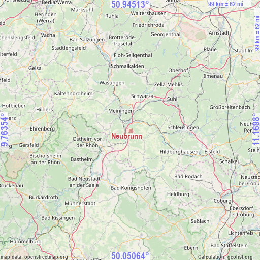
50° 30' 0" North, 10° 28' 0.012" East
| Map corner | latitude | longitude |
|---|---|---|
| Upper-left | 50.94513°, | 9.76354° |
| Center: | 50.5°, | 10.46667° |
| Lower-right: | 50.05064°, | 11.1698° |
| Map W x H: | 99.5×99.5 km | = 61.8×61.8mi |
| max Lat: | 55.01917° ⇑52.8% North |
| Neubrunn: | 50.5° |
| min Lat: | ⇓47.2% South 47.40724° |
| min Long | Neubrunn | max Long |
| 5.92978° | 10.46667° | 14.98853° |
| W 58.3%⇐ | ⇒41.7% E |
Elevation
Elevation of Neubrunn is 320 m = 1050 ft, and this is 70.9 m = 233 ft above average elevation for this country.
| Max E: |
1256 m = 4121 ft | 35.1% |
| Neubrunn | 320 m 1050 ft | |
| Avg. | 249.1 m = 817 ft | |
Min E: |
-5 m = -16 ft | 64.9% |
See also: Germany elevation on elevation.city.
Geographical zone
Neubrunn is located in North temperate zone (between Tropic of Cancer and the Arctic Circle). Distance of this North polar circle is 1786.1 km =1109.8 mi to North.| Distance of | km | miles | from Neubrunn |
|---|---|---|---|
| North Pole | 4392 | 2729.1 | to North |
| Arctic Circle | 1786.1 | 1109.8 | to North |
| Tropic Cancer | 3009.2 | 1869.8 | to South |
| Equator | 5615.1 | 3489.1 | to South |


Nearby cities:
15 places around Neubrunn: (largest is in red/bold)
• Belrieth
3.9 km =2.4 mi,  32°
32°
• Bibra
3.9 km =2.4 mi,  210°
210°
• Einhausen
3.2 km =2 mi,  353°
353°
• Ellingshausen
5.6 km =3.5 mi,  0°
0°
• Exdorf
7.2 km =4.5 mi,  131°
131°
• Henneberg
7.9 km =4.9 mi,  263°
263°
• Jüchsen
3.3 km =2.1 mi, 131°
• Leutersdorf
6.2 km =3.9 mi,  72°
72°
• Obermaßfeld-Grimmenthal
3.7 km =2.3 mi,  329°
329°
• Queienfeld
5.6 km =3.5 mi,  188°
188°
• Ritschenhausen
2.7 km =1.7 mi,  294°
294°
• Sülzfeld
8 km =5 mi, 288°
• Untermaßfeld
5.1 km =3.2 mi,  316°
316°
• Vachdorf
5.8 km =3.6 mi,  59°
59°
• Wölfershausen
3 km =1.9 mi,  231°
231°
Sources, notices
• [Note1] Compared only with cities in Germany existing in our database
• [Src1] Map data: © OpenStreetMap contributors (CC-BY-SA)
• [Src2] Other city data from geonames.org with taken over terms of usage.
• [Src3] Geographical zone / Annual Mean Temperature by Robert A. Rohde @ Wikipedia
