Henneberg geodata
Henneberg (Thuringia) is a seat of a fourth-order administrative division; located in Germany in Europe/Berlin (GMT+2) time zone. With population of 691 people, there are 8356 cities with bigger population in this country. Compared to other cities in Germany, 53% of cities are located further ↑North; 56.4% of cities are located further ←West and 76.5% of cities have lower elevation than Henneberg. Note1
Administrative division(s):
- Level 1: Thuringia
- Level 3: Landkreis Schmalkalden-Meiningen
- Level 4: Meiningen


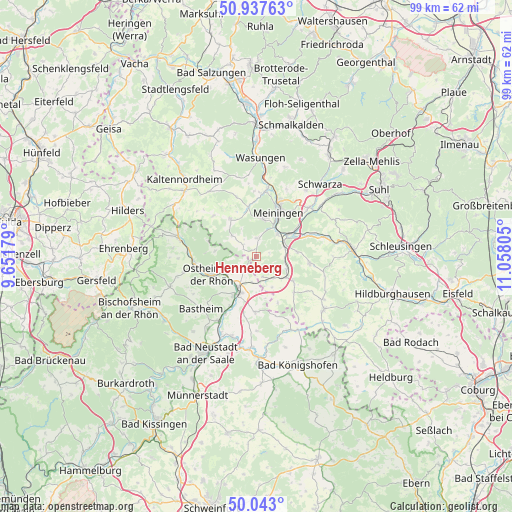
Henneberg GPS coordinates[2]
50° 29' 32.748" North, 10° 21' 17.712" East
| Map corner | latitude | longitude |
|---|---|---|
| Upper-left | 50.93763°, | 9.65179° |
| Center: | 50.49243°, | 10.35492° |
| Lower-right: | 50.043°, | 11.05805° |
| Map W x H: | 99.5×99.5 km | = 61.8×61.8mi |
| max Lat: | 55.01917° ⇑53% North |
| Henneberg: | 50.49243° |
| min Lat: | ⇓47% South 47.40724° |
| min Long | Henneberg | max Long |
| 5.92978° | 10.35492° | 14.98853° |
| W 56.4%⇐ | ⇒43.6% E |
Elevation
Elevation of Henneberg is 409 m = 1342 ft, and this is 159.9 m = 525 ft above average elevation for this country.
| Max E: |
1256 m = 4121 ft | 23.5% |
| Henneberg | 409 m 1342 ft | |
| Avg. | 249.1 m = 817 ft | |
Min E: |
-5 m = -16 ft | 76.5% |
See also: Germany elevation on elevation.city.
Geographical zone
Henneberg is located in North temperate zone (between Tropic of Cancer and the Arctic Circle). Distance of this North polar circle is 1786.9 km =1110.3 mi to North.| Distance of | km | miles | from Henneberg |
|---|---|---|---|
| North Pole | 4392.8 | 2729.6 | to North |
| Arctic Circle | 1786.9 | 1110.3 | to North |
| Tropic Cancer | 3008.3 | 1869.3 | to South |
| Equator | 5614.2 | 3488.5 | to South |


Nearby cities:
15 places around Henneberg: (largest is in red/bold)
• Bibra
6.5 km =4 mi,  113°
113°
• Einhausen
8.6 km =5.3 mi,  62°
62°
• Herpf
9.7 km =6 mi,  350°
350°
• Meiningen
9.4 km =5.8 mi,  26°
26°
• Mellrichstadt
8 km =5 mi,  207°
207°
• Neubrunn
7.9 km =4.9 mi,  83°
83°
• Obermaßfeld-Grimmenthal
7.2 km =4.5 mi, 55°
• Ostheim vor der Rhön
9.5 km =5.9 mi,  247°
247°
• Queienfeld
8.5 km =5.3 mi,  123°
123°
• Ritschenhausen
5.8 km =3.6 mi,  70°
70°
• Stockheim
6.9 km =4.3 mi,  237°
237°
• Sülzfeld
3.4 km =2.1 mi,  6°
6°
• Untermaßfeld
6.3 km =3.9 mi,  43°
43°
• Willmars
7.5 km =4.7 mi,  276°
276°
• Wölfershausen
5.6 km =3.5 mi,  100°
100°
Sources, notices
• [Note1] Compared only with cities in Germany existing in our database
• [Src1] Map data: © OpenStreetMap contributors (CC-BY-SA)
• [Src2] Other city data from geonames.org with taken over terms of usage.
• [Src3] Geographical zone / Annual Mean Temperature by Robert A. Rohde @ Wikipedia
