Exdorf geodata
Exdorf (Thuringia) is a populated place; located in Germany in Europe/Berlin (GMT+2) time zone. With population of 560 people, there are 9028 cities with bigger population in this country. Compared to other cities in Germany, 53.6% of cities are located further ↑North; 59.7% of cities are located further ←West and 71.1% of cities have lower elevation than Exdorf. Note1
Administrative division(s):
- Level 1: Thuringia
- Level 3: Landkreis Schmalkalden-Meiningen
- Level 4: Grabfeld


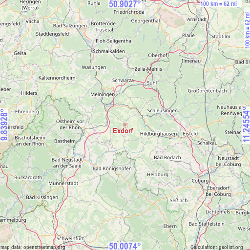
Exdorf GPS coordinates[2]
50° 27' 25.812" North, 10° 32' 32.676" East
| Map corner | latitude | longitude |
|---|---|---|
| Upper-left | 50.9027°, | 9.83928° |
| Center: | 50.45717°, | 10.54241° |
| Lower-right: | 50.0074°, | 11.24554° |
| Map W x H: | 99.5×99.5 km | = 61.8×61.8mi |
| max Lat: | 55.01917° ⇑53.6% North |
| Exdorf: | 50.45717° |
| min Lat: | ⇓46.4% South 47.40724° |
| min Long | Exdorf | max Long |
| 5.92978° | 10.54241° | 14.98853° |
| W 59.7%⇐ | ⇒40.3% E |
Elevation
Elevation of Exdorf is 367 m = 1204 ft, and this is 117.9 m = 387 ft above average elevation for this country.
| Max E: |
1256 m = 4121 ft | 28.9% |
| Exdorf | 367 m 1204 ft | |
| Avg. | 249.1 m = 817 ft | |
Min E: |
-5 m = -16 ft | 71.1% |
See also: Germany elevation on elevation.city.
Geographical zone
Exdorf is located in North temperate zone (between Tropic of Cancer and the Arctic Circle). Distance of this North polar circle is 1790.9 km =1112.8 mi to North.| Distance of | km | miles | from Exdorf |
|---|---|---|---|
| North Pole | 4396.8 | 2732 | to North |
| Arctic Circle | 1790.9 | 1112.8 | to North |
| Tropic Cancer | 3004.4 | 1866.8 | to South |
| Equator | 5610.3 | 3486.1 | to South |


Nearby cities:
15 places around Exdorf: (largest is in red/bold)
• Beinerstadt
4.2 km =2.6 mi,  75°
75°
• Bibra
7.5 km =4.7 mi,  280°
280°
• Dingsleben
4.9 km =3 mi,  123°
123°
• Ehrenberg
8.2 km =5.1 mi,  69°
69°
• Grimmelshausen
7.1 km =4.4 mi, 65°
• Henfstädt
7.3 km =4.5 mi,  25°
25°
• Jüchsen
3.8 km =2.4 mi,  311°
311°
• Leutersdorf
6.6 km =4.1 mi,  4°
4°
• Neubrunn
7.2 km =4.5 mi, 311°
• Queienfeld
6.2 km =3.9 mi,  262°
262°
• Reurieth
7.7 km =4.8 mi,  95°
95°
• Römhild
6.8 km =4.2 mi,  182°
182°
• Themar
7.4 km =4.6 mi,  44°
44°
• Vachdorf
7.7 km =4.8 mi,  357°
357°
• Wölfershausen
8.2 km =5.1 mi,  290°
290°
Sources, notices
• [Note1] Compared only with cities in Germany existing in our database
• [Src1] Map data: © OpenStreetMap contributors (CC-BY-SA)
• [Src2] Other city data from geonames.org with taken over terms of usage.
• [Src3] Geographical zone / Annual Mean Temperature by Robert A. Rohde @ Wikipedia
