Queienfeld geodata
Queienfeld (Thuringia) is a populated place; located in Germany in Europe/Berlin (GMT+2) time zone. With population of 538 people, there are 9146 cities with bigger population in this country. Compared to other cities in Germany, 53.7% of cities are located further ↑North; 58.2% of cities are located further ←West and 72.2% of cities have lower elevation than Queienfeld. Note1
Administrative division(s):
- Level 1: Thuringia
- Level 3: Landkreis Schmalkalden-Meiningen
- Level 4: Grabfeld


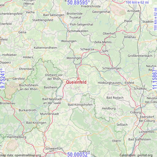
Queienfeld GPS coordinates[2]
50° 27' 1.26" North, 10° 27' 19.944" East
| Map corner | latitude | longitude |
|---|---|---|
| Upper-left | 50.89595°, | 9.75241° |
| Center: | 50.45035°, | 10.45554° |
| Lower-right: | 50.00052°, | 11.15867° |
| Map W x H: | 99.6×99.6 km | = 61.9×61.9mi |
| max Lat: | 55.01917° ⇑53.7% North |
| Queienfeld: | 50.45035° |
| min Lat: | ⇓46.3% South 47.40724° |
| min Long | Queienfeld | max Long |
| 5.92978° | 10.45554° | 14.98853° |
| W 58.2%⇐ | ⇒41.8% E |
Elevation
Elevation of Queienfeld is 375 m = 1230 ft, and this is 125.9 m = 413 ft above average elevation for this country.
| Max E: |
1256 m = 4121 ft | 27.8% |
| Queienfeld | 375 m 1230 ft | |
| Avg. | 249.1 m = 817 ft | |
Min E: |
-5 m = -16 ft | 72.2% |
See also: Germany elevation on elevation.city.
Geographical zone
Queienfeld is located in North temperate zone (between Tropic of Cancer and the Arctic Circle). Distance of this North polar circle is 1791.6 km =1113.2 mi to North.| Distance of | km | miles | from Queienfeld |
|---|---|---|---|
| North Pole | 4397.5 | 2732.5 | to North |
| Arctic Circle | 1791.6 | 1113.2 | to North |
| Tropic Cancer | 3003.6 | 1866.3 | to South |
| Equator | 5609.6 | 3485.6 | to South |


Nearby cities:
15 places around Queienfeld: (largest is in red/bold)
• Behrungen
5.3 km =3.3 mi,  213°
213°
• Belrieth
9.2 km =5.7 mi,  18°
18°
• Bibra
2.5 km =1.6 mi,  331°
331°
• Einhausen
8.7 km =5.4 mi,  2°
2°
• Exdorf
6.2 km =3.9 mi,  82°
82°
• Hendungen
9.6 km =6 mi,  229°
229°
• Henneberg
8.5 km =5.3 mi,  303°
303°
• Höchheim
9.3 km =5.8 mi,  182°
182°
• Jüchsen
4.6 km =2.9 mi,  44°
44°
• Neubrunn
5.6 km =3.5 mi,  8°
8°
• Obermaßfeld-Grimmenthal
8.8 km =5.5 mi,  352°
352°
• Ritschenhausen
6.9 km =4.3 mi, 346°
• Römhild
8.4 km =5.2 mi,  135°
135°
• Untermaßfeld
9.6 km =6 mi,  343°
343°
• Wölfershausen
4 km =2.5 mi, 336°
Sources, notices
• [Note1] Compared only with cities in Germany existing in our database
• [Src1] Map data: © OpenStreetMap contributors (CC-BY-SA)
• [Src2] Other city data from geonames.org with taken over terms of usage.
• [Src3] Geographical zone / Annual Mean Temperature by Robert A. Rohde @ Wikipedia
