Mülheim geodata
Mülheim (Rheinland-Pfalz) is a populated place; located in Germany in Europe/Berlin (GMT+2) time zone. With population of 921 people, there are 7452 cities with bigger population in this country. Compared to other cities in Germany, 66.1% of cities are located further ↑North; 93.1% of cities are located further →East and 64.5% of cities have higher elevation than Mülheim. Note1
Administrative division(s):
- Level 1: Rheinland-Pfalz
- Level 3: Landkreis Bernkastel-Wittlich
- Level 4: Mülheim (Mosel)


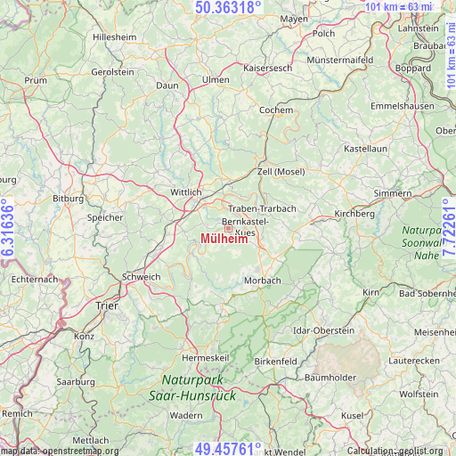
Mülheim GPS coordinates[2]
49° 54' 45.072" North, 7° 1' 10.164" East
| Map corner | latitude | longitude |
|---|---|---|
| Upper-left | 50.36318°, | 6.31636° |
| Center: | 49.91252°, | 7.01949° |
| Lower-right: | 49.45761°, | 7.72261° |
| Map W x H: | 100.7×100.7 km | = 62.6×62.6mi |
| max Lat: | 55.01917° ⇑66.1% North |
| Mülheim: | 49.91252° |
| min Lat: | ⇓33.9% South 47.40724° |
| min Long | Mülheim | max Long |
| 5.92978° | 7.01949° | 14.98853° |
| W 6.9%⇐ | ⇒93.1% E |
Elevation
Elevation of Mülheim is 124 m = 407 ft, and this is 125.1 m = 410 ft below average elevation for this country.
| Max E: |
1256 m = 4121 ft | 64.5% |
| Avg. | 249.1 m = 817 ft | |
| Mülheim | 124 m = 407 ft | |
Min E: |
-5 m = -16 ft | 35.5% |
See also: Germany elevation on elevation.city.
Geographical zone
Mülheim is located in North temperate zone (between Tropic of Cancer and the Arctic Circle). Distance of this North polar circle is 1851.4 km =1150.4 mi to North.| Distance of | km | miles | from Mülheim |
|---|---|---|---|
| North Pole | 4457.3 | 2769.6 | to North |
| Arctic Circle | 1851.4 | 1150.4 | to North |
| Tropic Cancer | 2943.8 | 1829.2 | to South |
| Equator | 5549.8 | 3448.5 | to South |


Nearby cities:
15 places around Mülheim: (largest is in red/bold)
• Bernkastel-Kues
4.1 km =2.5 mi,  84°
84°
• Brauneberg
2.8 km =1.7 mi,  254°
254°
• Burgen
3.5 km =2.2 mi,  203°
203°
• Gornhausen
5.5 km =3.4 mi,  156°
156°
• Graach
4 km =2.5 mi,  52°
52°
• Kesten
5.2 km =3.2 mi, 254°
• Kinheim
6.4 km =4 mi,  19°
19°
• Lieser
0.5 km =0.3 mi,  336°
336°
• Maring-Noviand
2.7 km =1.7 mi,  328°
328°
• Monzelfeld
4.5 km =2.8 mi,  120°
120°
• Osann-Monzel
5 km =3.1 mi,  275°
275°
• Platten
6.4 km =4 mi,  312°
312°
• Veldenz
2.7 km =1.7 mi,  176°
176°
• Wintrich
5.9 km =3.7 mi,  236°
236°
• Zeltingen-Rachtig
4.2 km =2.6 mi,  357°
357°
Sources, notices
• [Note1] Compared only with cities in Germany existing in our database
• [Src1] Map data: © OpenStreetMap contributors (CC-BY-SA)
• [Src2] Other city data from geonames.org with taken over terms of usage.
• [Src3] Geographical zone / Annual Mean Temperature by Robert A. Rohde @ Wikipedia
