Bernkastel-Kues geodata
Bernkastel-Kues (Rheinland-Pfalz) is a populated place; located in Germany in Europe/Berlin (GMT+2) time zone. With population of 6,880 people, there are 2207 cities with bigger population in this country. Compared to other cities in Germany, 66% of cities are located further ↑North; 92.6% of cities are located further →East and 65.2% of cities have higher elevation than Bernkastel-Kues. Note1
Administrative division(s):
- Level 1: Rheinland-Pfalz
- Level 3: Landkreis Bernkastel-Wittlich
- Level 4: Bernkastel-Kues


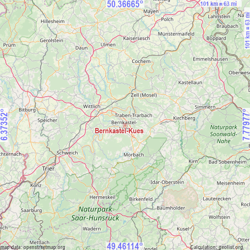
Bernkastel-Kues GPS coordinates[2]
49° 54' 57.672" North, 7° 4' 35.904" East
| Map corner | latitude | longitude |
|---|---|---|
| Upper-left | 50.36665°, | 6.37352° |
| Center: | 49.91602°, | 7.07664° |
| Lower-right: | 49.46114°, | 7.77977° |
| Map W x H: | 100.7×100.7 km | = 62.6×62.6mi |
| max Lat: | 55.01917° ⇑66% North |
| Bernkastel-Kues: | 49.91602° |
| min Lat: | ⇓34% South 47.40724° |
| min Long | Bernkastel-Kues | max Long |
| 5.92978° | 7.07664° | 14.98853° |
| W 7.4%⇐ | ⇒92.6% E |
Elevation
Elevation of Bernkastel-Kues is 119 m = 390 ft, and this is 130.1 m = 427 ft below average elevation for this country.
| Max E: |
1256 m = 4121 ft | 65.2% |
| Avg. | 249.1 m = 817 ft | |
| Bernkastel-Kues | 119 m = 390 ft | |
Min E: |
-5 m = -16 ft | 34.8% |
See also: Germany elevation on elevation.city.
Geographical zone
Bernkastel-Kues is located in North temperate zone (between Tropic of Cancer and the Arctic Circle). Distance of this North polar circle is 1851 km =1150.2 mi to North.| Distance of | km | miles | from Bernkastel-Kues |
|---|---|---|---|
| North Pole | 4456.9 | 2769.4 | to North |
| Arctic Circle | 1851 | 1150.2 | to North |
| Tropic Cancer | 2944.2 | 1829.4 | to South |
| Equator | 5550.1 | 3448.7 | to South |


Nearby cities:
15 places around Bernkastel-Kues: (largest is in red/bold)
• Brauneberg
6.9 km =4.3 mi,  260°
260°
• Burgen
6.6 km =4.1 mi,  236°
236°
• Gornhausen
5.8 km =3.6 mi,  199°
199°
• Graach
2.3 km =1.4 mi,  335°
335°
• Kinheim
5.9 km =3.7 mi, 341°
• Kommen
5.4 km =3.4 mi,  131°
131°
• Lieser
4.3 km =2.7 mi,  270°
270°
• Longkamp
4.1 km =2.5 mi, 134°
• Maring-Noviand
5.8 km =3.6 mi,  289°
289°
• Monzelfeld
2.6 km =1.6 mi,  185°
185°
• Mülheim
4.1 km =2.5 mi, 264°
• Starkenburg
6.9 km =4.3 mi,  35°
35°
• Traben-Trarbach
4.8 km =3 mi, 35°
• Veldenz
5 km =3.1 mi,  232°
232°
• Zeltingen-Rachtig
5.7 km =3.5 mi,  311°
311°
Sources, notices
• [Note1] Compared only with cities in Germany existing in our database
• [Src1] Map data: © OpenStreetMap contributors (CC-BY-SA)
• [Src2] Other city data from geonames.org with taken over terms of usage.
• [Src3] Geographical zone / Annual Mean Temperature by Robert A. Rohde @ Wikipedia
