Möllenhagen geodata
Möllenhagen (Mecklenburg-Vorpommern) is a populated place; located in Germany in Europe/Berlin (GMT+2) time zone. With population of 1,984 people, there are 5095 cities with bigger population in this country. Compared to other cities in Germany, 85.8% of cities are located further ↓South; 91.7% of cities are located further ←West and 70.4% of cities have higher elevation than Möllenhagen. Note1
Administrative division(s):
- Level 1: Mecklenburg-Vorpommern
- Level 3: Mecklenburgische Seenplatte
- Level 4: Möllenhagen


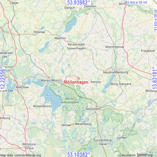
Möllenhagen GPS coordinates[2]
53° 31' 25.968" North, 12° 55' 43.248" East
| Map corner | latitude | longitude |
|---|---|---|
| Upper-left | 53.93982°, | 12.22556° |
| Center: | 53.52388°, | 12.92868° |
| Lower-right: | 53.10382°, | 13.63181° |
| Map W x H: | 93×93 km | = 57.8×57.8mi |
| max Lat: | 55.01917° ⇑14.2% North |
| Möllenhagen: | 53.52388° |
| min Lat: | ⇓85.8% South 47.40724° |
| min Long | Möllenhagen | max Long |
| 5.92978° | 12.92868° | 14.98853° |
| W 91.7%⇐ | ⇒8.3% E |
Elevation
Elevation of Möllenhagen is 89 m = 292 ft, and this is 160.1 m = 525 ft below average elevation for this country.
| Max E: |
1256 m = 4121 ft | 70.4% |
| Avg. | 249.1 m = 817 ft | |
| Möllenhagen | 89 m = 292 ft | |
Min E: |
-5 m = -16 ft | 29.6% |
See also: Germany elevation on elevation.city.
Geographical zone
Möllenhagen is located in North temperate zone (between Tropic of Cancer and the Arctic Circle). Distance of this North polar circle is 1449.9 km =900.9 mi to North.| Distance of | km | miles | from Möllenhagen |
|---|---|---|---|
| North Pole | 4055.8 | 2520.2 | to North |
| Arctic Circle | 1449.9 | 900.9 | to North |
| Tropic Cancer | 3345.4 | 2078.7 | to South |
| Equator | 5951.3 | 3698 | to South |


Nearby cities:
15 places around Möllenhagen: (largest is in red/bold)
• Ankershagen
5.5 km =3.4 mi,  152°
152°
• Blankenhof
14.6 km =9.1 mi,  65°
65°
• Faulenrost
15.7 km =9.8 mi,  323°
323°
• Groß Gievitz
11.6 km =7.2 mi,  303°
303°
• Groß Plasten
5.7 km =3.5 mi, 295°
• Hohenzieritz
14.4 km =8.9 mi,  128°
128°
• Jürgenstorf
15.3 km =9.5 mi,  354°
354°
• Kargow
9.7 km =6 mi,  261°
261°
• Klein Vielen
10.3 km =6.4 mi,  140°
140°
• Knorrendorf
15 km =9.3 mi,  37°
37°
• Kratzeburg
10.5 km =6.5 mi,  175°
175°
• Mölln
12.7 km =7.9 mi,  54°
54°
• Penzlin
10.5 km =6.5 mi,  102°
102°
• Ritzerow
15.5 km =9.6 mi,  8°
8°
• Rosenow
13.8 km =8.6 mi,  31°
31°
Sources, notices
• [Note1] Compared only with cities in Germany existing in our database
• [Src1] Map data: © OpenStreetMap contributors (CC-BY-SA)
• [Src2] Other city data from geonames.org with taken over terms of usage.
• [Src3] Geographical zone / Annual Mean Temperature by Robert A. Rohde @ Wikipedia
