Hohenzieritz geodata
Hohenzieritz (Mecklenburg-Vorpommern) is a populated place; located in Germany in Europe/Berlin (GMT+2) time zone. With population of 564 people, there are 9006 cities with bigger population in this country. Compared to other cities in Germany, 84.9% of cities are located further ↓South; 93% of cities are located further ←West and 73% of cities have higher elevation than Hohenzieritz. Note1
Administrative division(s):
- Level 1: Mecklenburg-Vorpommern
- Level 3: Mecklenburgische Seenplatte
- Level 4: Hohenzieritz


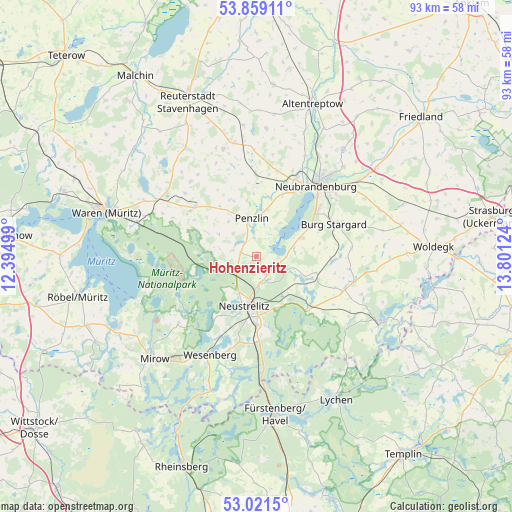
Hohenzieritz GPS coordinates[2]
53° 26' 32.532" North, 13° 5' 53.196" East
| Map corner | latitude | longitude |
|---|---|---|
| Upper-left | 53.85911°, | 12.39499° |
| Center: | 53.44237°, | 13.09811° |
| Lower-right: | 53.0215°, | 13.80124° |
| Map W x H: | 93.1×93.1 km | = 57.8×57.8mi |
| max Lat: | 55.01917° ⇑15.1% North |
| Hohenzieritz: | 53.44237° |
| min Lat: | ⇓84.9% South 47.40724° |
| min Long | Hohenzieritz | max Long |
| 5.92978° | 13.09811° | 14.98853° |
| W 93%⇐ | ⇒7% E |
Elevation
Elevation of Hohenzieritz is 72 m = 236 ft, and this is 177.1 m = 581 ft below average elevation for this country.
| Max E: |
1256 m = 4121 ft | 73% |
| Avg. | 249.1 m = 817 ft | |
| Hohenzieritz | 72 m = 236 ft | |
Min E: |
-5 m = -16 ft | 27% |
See also: Germany elevation on elevation.city.
Geographical zone
Hohenzieritz is located in North temperate zone (between Tropic of Cancer and the Arctic Circle). Distance of this North polar circle is 1458.9 km =906.5 mi to North.| Distance of | km | miles | from Hohenzieritz |
|---|---|---|---|
| North Pole | 4064.8 | 2525.7 | to North |
| Arctic Circle | 1458.9 | 906.5 | to North |
| Tropic Cancer | 3336.3 | 2073.1 | to South |
| Equator | 5942.2 | 3692.3 | to South |


Nearby cities:
15 places around Hohenzieritz: (largest is in red/bold)
• Ankershagen
9.6 km =6 mi,  295°
295°
• Blankenhof
15.2 km =9.4 mi,  8°
8°
• Blankensee
12.1 km =7.5 mi,  110°
110°
• Blumenholz
3.5 km =2.2 mi,  155°
155°
• Carpin
13.5 km =8.4 mi,  134°
134°
• Groß Nemerow
9.1 km =5.7 mi,  67°
67°
• Holldorf
11.8 km =7.3 mi,  77°
77°
• Klein Vielen
4.8 km =3 mi,  283°
283°
• Kratzeburg
10.5 km =6.5 mi,  262°
262°
• Möllenhagen
14.4 km =8.9 mi,  308°
308°
• Neustrelitz
9.2 km =5.7 mi,  190°
190°
• Penzlin
6.9 km =4.3 mi,  352°
352°
• Userin
13.9 km =8.6 mi,  214°
214°
• Wulkenzin
12.3 km =7.6 mi,  22°
22°
• Wustrow
5.5 km =3.4 mi,  44°
44°
Sources, notices
• [Note1] Compared only with cities in Germany existing in our database
• [Src1] Map data: © OpenStreetMap contributors (CC-BY-SA)
• [Src2] Other city data from geonames.org with taken over terms of usage.
• [Src3] Geographical zone / Annual Mean Temperature by Robert A. Rohde @ Wikipedia
