Moers geodata
Moers (North Rhine-Westphalia) is a populated place; located in Germany in Europe/Berlin (GMT+2) time zone. With population of 107,816 people, there are 87 cities with bigger population in this country. Compared to other cities in Germany, 65.6% of cities are located further ↓South; 96.8% of cities are located further →East and 87.3% of cities have higher elevation than Moers. Note1
Administrative division(s):
- Level 1: North Rhine-Westphalia
- Level 2: Düsseldorf District
- Level 3: Kreis Wesel
- Level 4: Moers


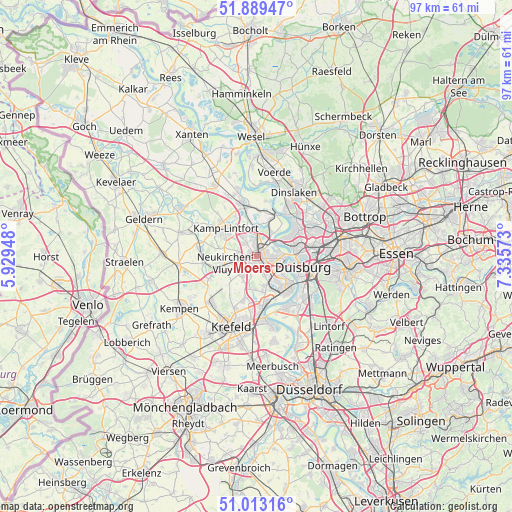
Moers GPS coordinates[2]
51° 27' 12.312" North, 6° 37' 57.36" East
| Map corner | latitude | longitude |
|---|---|---|
| Upper-left | 51.88947°, | 5.92948° |
| Center: | 51.45342°, | 6.6326° |
| Lower-right: | 51.01316°, | 7.33573° |
| Map W x H: | 97.4×97.4 km | = 60.5×60.5mi |
| max Lat: | 55.01917° ⇑34.4% North |
| Moers: | 51.45342° |
| min Lat: | ⇓65.6% South 47.40724° |
| min Long | Moers | max Long |
| 5.92978° | 6.6326° | 14.98853° |
| W 3.2%⇐ | ⇒96.8% E |
Elevation
Elevation of Moers is 29 m = 95 ft, and this is 220.1 m = 722 ft below average elevation for this country.
| Max E: |
1256 m = 4121 ft | 87.3% |
| Avg. | 249.1 m = 817 ft | |
| Moers | 29 m = 95 ft | |
Min E: |
-5 m = -16 ft | 12.7% |
See also: Moers elevation on elevation.city.
Geographical zone
Moers is located in North temperate zone (between Tropic of Cancer and the Arctic Circle). Distance of this North polar circle is 1680.1 km =1044 mi to North.| Distance of | km | miles | from Moers |
|---|---|---|---|
| North Pole | 4286 | 2663.2 | to North |
| Arctic Circle | 1680.1 | 1044 | to North |
| Tropic Cancer | 3115.2 | 1935.7 | to South |
| Equator | 5721.1 | 3554.9 | to South |


Nearby cities:
15 places around Moers: (largest is in red/bold)
• Alpen
16.5 km =10.3 mi,  330°
330°
• Dinslaken
14.3 km =8.9 mi,  32°
32°
• Duisburg
9.5 km =5.9 mi,  104°
104°
• Hochfeld
9.3 km =5.8 mi,  114°
114°
• Issum
16.4 km =10.2 mi,  302°
302°
• Kamp-Lintfort
8.3 km =5.2 mi,  313°
313°
• Kempen
17.8 km =11.1 mi,  236°
236°
• Krefeld
14.1 km =8.8 mi,  202°
202°
• Meiderich
9.4 km =5.8 mi,  80°
80°
• Mülheim
17.3 km =10.7 mi, 97°
• Oberhausen
16.2 km =10.1 mi, 80°
• Rheinberg
10.7 km =6.6 mi,  345°
345°
• Rheurdt
11.6 km =7.2 mi,  277°
277°
• Tönisvorst
17.6 km =10.9 mi,  213°
213°
• Voerde
16.4 km =10.2 mi,  13°
13°
Sources, notices
• [Note1] Compared only with cities in Germany existing in our database
• [Src1] Map data: © OpenStreetMap contributors (CC-BY-SA)
• [Src2] Other city data from geonames.org with taken over terms of usage.
• [Src3] Geographical zone / Annual Mean Temperature by Robert A. Rohde @ Wikipedia
