Issum geodata
Issum (North Rhine-Westphalia) is a seat of a fourth-order administrative division; located in Germany in Europe/Berlin (GMT+2) time zone. With population of 12,249 people, there are 1335 cities with bigger population in this country. Compared to other cities in Germany, 66.7% of cities are located further ↓South; 98.3% of cities are located further →East and 88.6% of cities have higher elevation than Issum. Note1
Administrative division(s):
- Level 1: North Rhine-Westphalia
- Level 2: Düsseldorf District
- Level 3: Kreis Kleve
- Level 4: Issum


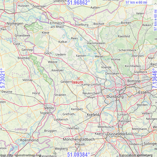
Issum GPS coordinates[2]
51° 31' 59.988" North, 6° 25' 59.988" East
| Map corner | latitude | longitude |
|---|---|---|
| Upper-left | 51.96862°, | 5.73021° |
| Center: | 51.53333°, | 6.43333° |
| Lower-right: | 51.09384°, | 7.13646° |
| Map W x H: | 97.3×97.3 km | = 60.5×60.5mi |
| max Lat: | 55.01917° ⇑33.3% North |
| Issum: | 51.53333° |
| min Lat: | ⇓66.7% South 47.40724° |
| min Long | Issum | max Long |
| 5.92978° | 6.43333° | 14.98853° |
| W 1.7%⇐ | ⇒98.3% E |
Elevation
Elevation of Issum is 25 m = 82 ft, and this is 224.1 m = 735 ft below average elevation for this country.
| Max E: |
1256 m = 4121 ft | 88.6% |
| Avg. | 249.1 m = 817 ft | |
| Issum | 25 m = 82 ft | |
Min E: |
-5 m = -16 ft | 11.4% |
See also: Germany elevation on elevation.city.
Geographical zone
Issum is located in North temperate zone (between Tropic of Cancer and the Arctic Circle). Distance of this North polar circle is 1671.2 km =1038.4 mi to North.| Distance of | km | miles | from Issum |
|---|---|---|---|
| North Pole | 4277.1 | 2657.7 | to North |
| Arctic Circle | 1671.2 | 1038.4 | to North |
| Tropic Cancer | 3124.1 | 1941.2 | to South |
| Equator | 5730 | 3560.5 | to South |


Nearby cities:
15 places around Issum: (largest is in red/bold)
• Alpen
8 km =5 mi,  46°
46°
• Geldern
7.8 km =4.8 mi,  258°
258°
• Kamp-Lintfort
8.4 km =5.2 mi,  112°
112°
• Kempen
18.8 km =11.7 mi,  183°
183°
• Kevelaer
14.1 km =8.8 mi,  292°
292°
• Moers
16.4 km =10.2 mi,  122°
122°
• Rheinberg
11.3 km =7 mi,  82°
82°
• Rheurdt
7.8 km =4.8 mi,  162°
162°
• Sonsbeck
9 km =5.6 mi,  335°
335°
• Straelen
15.4 km =9.6 mi,  228°
228°
• Uedem
18.3 km =11.4 mi,  323°
323°
• Voerde
18.9 km =11.7 mi,  67°
67°
• Wachtendonk
15.3 km =9.5 mi,  205°
205°
• Wemb
18.7 km =11.6 mi, 288°
• Xanten
14 km =8.7 mi,  5°
5°
Sources, notices
• [Note1] Compared only with cities in Germany existing in our database
• [Src1] Map data: © OpenStreetMap contributors (CC-BY-SA)
• [Src2] Other city data from geonames.org with taken over terms of usage.
• [Src3] Geographical zone / Annual Mean Temperature by Robert A. Rohde @ Wikipedia
