Mittenwald geodata
Mittenwald (Bavaria) is a populated place; located in Germany in Europe/Berlin (GMT+2) time zone. With population of 7,996 people, there are 1955 cities with bigger population in this country. Compared to other cities in Germany, 100% of cities are located further ↑North; 70.8% of cities are located further ←West and 99.9% of cities have lower elevation than Mittenwald. Note1
Administrative division(s):
- Level 1: Bavaria
- Level 2: Upper Bavaria
- Level 3: Landkreis Garmisch-Partenkirchen
- Level 4: Mittenwald, Markt


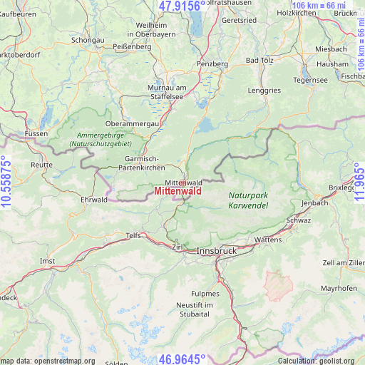
Mittenwald GPS coordinates[2]
47° 26' 31.92" North, 11° 15' 42.732" East
| Map corner | latitude | longitude |
|---|---|---|
| Upper-left | 47.9156°, | 10.55875° |
| Center: | 47.4422°, | 11.26187° |
| Lower-right: | 46.9645°, | 11.965° |
| Map W x H: | 105.8×105.8 km | = 65.7×65.7mi |
| max Lat: | 55.01917° ⇑100% North |
| Mittenwald: | 47.4422° |
| min Lat: | ⇓0% South 47.40724° |
| min Long | Mittenwald | max Long |
| 5.92978° | 11.26187° | 14.98853° |
| W 70.8%⇐ | ⇒29.2% E |
Elevation
Elevation of Mittenwald is 915 m = 3002 ft, and this is 665.9 m = 2185 ft above average elevation for this country.
| Max E: |
1256 m = 4121 ft | 0.099999999999994% |
| Mittenwald | 915 m 3002 ft | |
| Avg. | 249.1 m = 817 ft | |
Min E: |
-5 m = -16 ft | 99.9% |
See also: Germany elevation on elevation.city.
Geographical zone
Mittenwald is located in North temperate zone (between Tropic of Cancer and the Arctic Circle). Distance of this North polar circle is 2126.1 km =1321.1 mi to North.| Distance of | km | miles | from Mittenwald |
|---|---|---|---|
| North Pole | 4732 | 2940.3 | to North |
| Arctic Circle | 2126.1 | 1321.1 | to North |
| Tropic Cancer | 2669.2 | 1658.6 | to South |
| Equator | 5275.1 | 3277.8 | to South |


Nearby cities:
15 places around Mittenwald: (largest is in red/bold)
• Eschenlohe
18.5 km =11.5 mi,  341°
341°
• Ettal
18.4 km =11.4 mi,  318°
318°
• Farchant
15 km =9.3 mi,  310°
310°
• Garmisch-Partenkirchen
13.7 km =8.5 mi,  293°
293°
• Grainau
18.3 km =11.4 mi,  281°
281°
• Großweil
26.2 km =16.3 mi,  6°
6°
• Jachenau
22.3 km =13.9 mi,  35°
35°
• Kochel
25.4 km =15.8 mi,  18°
18°
• Krün
7.1 km =4.4 mi, 10°
• Oberammergau
22.7 km =14.1 mi, 319°
• Oberau
16 km =9.9 mi, 324°
• Ohlstadt
21.4 km =13.3 mi,  354°
354°
• Schlehdorf
24.3 km =15.1 mi, 9°
• Schwaigen
21.1 km =13.1 mi, 336°
• Wallgau
8.4 km =5.2 mi, 11°
Sources, notices
• [Note1] Compared only with cities in Germany existing in our database
• [Src1] Map data: © OpenStreetMap contributors (CC-BY-SA)
• [Src2] Other city data from geonames.org with taken over terms of usage.
• [Src3] Geographical zone / Annual Mean Temperature by Robert A. Rohde @ Wikipedia
